Of the 46 presidents who have steered the helm of the United States, only one has ever hailed from the Pacific Northwest.
The 31st president of the United States, Herbert Hoover, was born in West Branch, Iowa on August 10th, 1874 into modest beginnings; not so much because his family was poor, but because their beliefs honored humility. Herbert’s father, Jesse Hoover, was a blacksmith turned farm store owner who passed away in 1880. His mother, Hulda Randall Minthorn Hoover, who was a school teacher prior to marrying Jesse Hoover, died in 1884. Orphaned at the age of 9, young Bert was sent to live with his Uncle and Aunt, Dr. John Minthorn and wife Laura, in Newberg, Oregon in November 1885.
Although his stay there was relatively brief, a mere 3 years or so, Bertie and Newberg managed to make permanent impressions upon each other; today stands the historical house in Newberg which provides an important history lesson to those who visit, and before Herbert Hoover’s death in 1964 he was able to cherish and share some of his fondest memories of the small town he had so long ago called home. He wrote in his memoirs, “Oregon lives in my mind for its gleaming wheat fields, its abundant fruit, its luxuriant forest vegetation, and the fish in its mountain streams. To step into its forests with their tangles of berry bushes, their ferns, their masses of wild-flowers stirs up odors peculiar to Oregon. Within these woods are never-ending journeys of discovery.” His aunt Laura’s pear tree also left an indelible impression on Bert; It is said that he was so sick from overeating the pears which he loved so much that he never touched another.
The Hoover-Minthorn House at 115 South River Street in Newberg is a museum maintained by The National Society of The Colonial Dames of America in Oregon. This childhood home of Herbert Hoover was built in 1881 by Jesse Edwards, founder of Newberg, and is the oldest residence in town. The house can be classified as an 1880’s Vernacular and has Italianate detail in the trim under the eaves.
The Minthorn family moved to Salem in 1888, then Hoover went off to study at Stanford university in 1891, becoming such a successful mining engineer that he retired from mining in 1912. During World War 1, even before the United States entered the battle, Hoover devised a plan to feed the starving civilians of war-torn France and Belgium, a plan that by the end of the war would save close to 10 million lives; 2 million French and 7 million Belgians. This gargantuan humanitarian effort endeared Hoover to many, and he continued to be successful in government. While Secretary of Commerce, Hoover often warned President Calvin Coolidge of the dangers of Stock Market speculation, but as finances were booming, Hoover’s warning went mostly unheeded. It is while Hoover served as President from 1929 to 1933 that the crash which he had foreseen occurred in such a degree that not even he could engineer a successful solution.
In 1947, nearly 20 years after Hoover’s term as President, a childhood friend, Burt Brown Barker, began to organize, collect, and restore Hoover’s boyhood home and furninshings to what is now known as the Hoover-Minthorn House; a museum where visitors can see Hoover’s actual bedroom set, period pieces such as a baby cradle, a wood stove, a kitchen queen, a well bucket, a butter churn, some of Hoover’s own fly fishing gear, and more. The Hoover-Minthorn house was dedicated by Herbert Hoover on August 10th, 1955; Hoover’s 81st birthday.
From the Cascades’ frozen gorges, Leaping like a child at play, Winding, winding through the valley, Bright Willamette glides away; Onward ever, Lovely river, Softly calling to the sea, Time, that scars us, Leaves no track or trench on thee—
—Samuel L. Simpson (1845-1899)
Seventy percent of Oregon’s residents live in the Willamette Valley, most within a 20 minute drive of the Willamette River. These Valley residents live in harmony with the river all along its 187 mile journey as it travels from just south of Springfield and flows north to spill into the largest river in the Pacific Northwest; the Columbia.
The Willamette valley is cradled by mountain ranges on three sides: the Cascade mountains on the east side, the Coastal Range on the west, and the Calapooya Mountain range to the south. In past years it was not unusual for flooding to occur in the valley, especially between December and February when snow would come to the mountains in late fall or early winter, a warm spell would light on it, and the snow melt would run off into the Willamette’s tributaries causing the Willamette River to rise and send all of its riverside inhabitants scurrying to higher ground. It was not long after settling in the area that the earliest Euro-Americans experienced a deluge from what is known as the Willamette’s 100 year flood tendency, quickly and surely learning how mighty the Willamette can be.
On December 6, 1861 the Willamette River flooded the town of Champoeg as well as other towns along its labyrinthine banks. This flood was so great that the course of the river was permanently altered, causing people to move in order to stay close to the river which they depended on as a major transportation network. Farmers needed to transport their wheat to Portland and Vancouver for distribution to California and Russia, there was a water-powered grist mill operating on the river, and many steamboat landings were used by passengers for the transport of livestock, produce, and other goods.
Unlike the native Kalapuya, who were stewards of the valley long before the settlers arrived and were quite mobile, the Euro-Americans were intent on building a permanent residence. By 1861 Champoeg was a bustling center for commerce with a steady population of 200 people working in stores, as blacksmiths, running livery stables, saloons, a hotel, churches, a school and other services such as health care and carpentry. Very little was salvaged from the area after the great flood rescinded. It was with this flood that the Willamette River introduced itself to the settlers with a colossal force.
Thirty miles South of Champoeg sat a town west of Salem called Eola that was forever lost to the great flood of 1861. Eola was a thriving river town until the flood changed the course of the Willamette River and drowned it out. Eola was settled by Joshua Shaw and his son, who were the first to bring sheep overland to the Oregon Country along the Oregon Trail (1844). Upon arriving, they called the town Cincinnati, for it so resembled the town where Joshua once lived.
Within a few years of arriving in Eola (Cincinatti), Abigail J. Scott became the town’s first school teacher though she had very little education herself; having gained much of her knowledge from reading books along the trail to Oregon. It is this very same Abigail J. Scott who later became Abigail Scott Duniway, Oregon’s leading suffragist.
The Willamette River has a long, well-documented history of flooding the valley:
1861: is the largest flood of the Willamette River on record.
1890: was a very significant flood.
1964: the “Christmas Flood,” rated by FEMA as a 100 year flood. $157 million in damage and 20 people lost their lives.
1996: flooding occurred despite the use of the dams along the tributaries because of the extreme weather occurrences: rapid, deep snow in the cascades/mountain ranges the last two weeks of January, sudden torrential freezing rain for a few days, then tropical rain came through melting the snow pack and flooding areas where it pummeled frozen ground.
Due to its fertile plain, the Willamette Valley became more and more populated, but the threat of flooding was never far from thought. In 1936, Congress passed the Flood Control Act, which asserted that the federal government would aid in flood control on navigable waters.Soon the Willamette Valley Project was developed and over the next 35 years the 13 Willamette tributary dams would be constructed.
In 1941 the first of the Willamette tributary dams was completed. Along the Long Tom River, Approximately 12 miles west of Eugene, the Fern Ridge Dam and Lake is known to be an excellent spot for birding and viewing wildlife. It is operated primarily for recreation in the summer where water related activities abound. It is also an important element for flood control in the winter and is part of a major wildlife management area. Lane County runs five parks along the shores of Fern Ridge Lake, the Army Corps of engineers and the Oregon Fish and Wildlife operate a wildlife area as well as a park, and Fern Ridge Lake is home to the Eugene Yacht Club. All this can be found on this lake with a summertime area of 4.5 miles masterfully contained by a 6,330 ft. long, 44 ft. high earth-fill dam with a concrete spillway. Fern Ridge Lake is one of the most popular recreational spots in the region.
Cottage Grove Dam was built in 1942 on the Coast Fork Willamette River approximately 5 miles south of Cottage Grove. The lake is a popular area for boating, water-skiing, camping, and fishing. Analyses of fish tissue has shown disconcerting levels of mercury in the fish, likely due to Black Butte mine, just two miles away, which was once one of the largest producers of mercury in Oregon. Arsenic has also been reported in the area downstream from the dam at London Springs.
Dorena Dam was completed in 1949 along the Row River, about six miles east of Cottage Grove. It is a popular boating lake, lending itself more to sailing ventures than to the water skiers of nearby Cottage Grove Lake. The city of Cottage Grove rests where the Coast Fork of the Willamette River meets the Row River, and Silk Creek runs through the west side of Cottage Grove, all of which make Cottage Grove a prime target for flooding. Before Dorena Dam was built, flooding was nearly as frequent as rainfall in Cottage Grove, but thanks to the Cottage Grove and Dorena Dams, flooding is less of a threat.
At 463 ft., Detroit Dam, 1953, is the largest of all the Willamette River tributary dams and the first constructed with hydro-power capabilities, hosting two power generators. The first of the Willamette Valley Project dams to be built after WW11, the 110 MW producing dam is Located on the North Santiam River approximately 45 miles southeast of Salem. Detroit Dam was intended primarily for flood control and the generation of power, but the reservoir has become one of the most popular recreation sites in western Oregon. Measuring 9 miles, Detroit’s lake is nearly twice as large as Fern Ridge’s, yet its 735.000 yearly recreational visits only come close to the 768,000 visitors to Fern Ridge. All things boating, swimming, camping, and fishing are enjoyed at Detroit Lake. The U.S. Forest Service operates four campgrounds, and the Oregon Department of Parks and Recreation manage two parks on the Lake.
Big Cliff Dam was built in 1953 as a re-regulator of the water released from Detroit Dam just 3 miles upstream. The purpose of the Big Cliff Dam is to aid in providing uniform stream flow into the North Santiam River. With Detroit Lake so close and easily accessible, Big Cliff Lake is not considered a recreational facility because of its small size and that its high cliffs making it difficult to access.
Lookout Point Dam, built in 1954, is located about 22 miles southeast of Eugene on the Middle Fork Willamette River. Lookout Point Lake is a very large reservoir extending for more than 14 miles along the Middle Fork of the Willamette River to the Calapooya Mountains S.E. of Eugene. Not only has this Dam, coupled with Dexter as its re-regulator, prevented hundreds of millions of dollars in damage, it is also an important dam for the production of hydroelectric power. The lake is a poor fishing area, but popular for other water and boating sports and is home to many species of wildlife and flora. The 3,381 ft. long embankment structure contains a 274 ft. long concrete spillway with 5 gates. Controlled releases of the water aid in water level control, power generation, and pollution control.
Dexter Dam was built in 1954 2.8 miles downstream from Lookout Point Dam as a re-regulator. Because of its ease of access, water-skiers, sail-boaters, and anglers make Dexter Dam a popular day use recreation area; more so than Lookout Point. Together, Lookout Point and Dexter Dams have prevented more than $5.3 billion in potential flood damage. Combined, they utilize four power generators responsible for generating more than 370 MWHs of electricity.
In 1961 Hills Creek Dam was completed on the Middle Fork Willamette River about 45 miles southeast of Eugene. Hills Creek is operated in conjunction with Lookout Point downstream to meet the flow needs on the Willamette River during the summer. Windsurfers, water-skiers, sailers, swimmers, canoers, kayakers, and anglers, all enjoy recreating on this reservoir’s 2,735 acre water surface. The 44-mile shoreline is managed as a wildlife habitat, with a 130-acre wetland area below the dam hosting fields, ponds, fowl, and beaver dams.
Cougar Dam, 1963-64, built on the south fork of the McKenzie River, is the highest embankment dam ever built by the corps, reaching 452 ft. above the stream bed. A rock fill structure with a concrete spillway, It houses two power generators. Cougar Dam has a temperature control tower which takes water from the reservoir and spills it into the river at a controlled temperature in order to facilitate the spawning of salmon. Near Cougar Dam is a national forest for hiking and the Cougar hot springs for relaxing.
Fall Creek Dam was built in 1966 on Fall Creek, a tributary of the Middle Fork Willamette River, approximately 22 miles southeast of Eugene. The lake is a popular spot for all manner of water recreation and the shores are a favorite for hiking and wildlife viewing.
Green Peter Dam, built in 1968 on the Middle Santiam River, is a 380-foot concrete structure which has a gated spillway and two power generators. This dam is in a key location, resulting in the prevention of millions of dollars in damage since its completion. The reservoir, which is popular for boating and fishing, is known as western Oregon’s premier Kokanee fishing lake.
In 1968 Foster Dam on the South Santiam River was completed east of Sweet Home. It is a re-regulator of the water spilled from Green Peter Dam. Foster Dam plays an important role in storing water for flood control, irrigation, and power production. The reservoir is the most popular water-spot in the county, offering swimming, boating, fishing, camping, hiking and picnicking.
1969 brought the completion of the final dam of The Willamette Valley Project, first set to planning over thirty years previous. Blue River Dam is located approximately 38 miles east of Eugene on the Blue River, a tributary of the McKenzie River. The reservoir is a popular spot for fishing, swimming, water-skiing, and camping.
There has been no wide-spread, devastating flooding in the Willamette Valley since the completion of the dams, and the hydro-power generates enough electricity to power 300,000 homes. Many of the valley’s homes, farms, and businesses exist solely because the dams prevent the flooding of the Willamette River. Much of Oregon’s population lives, grows, and does business on the flood plain of the Willamette.
Niney-six percent of the land in the Willamette Valley is privately owned and 50% of that land is used for agriculture (including land used to raise livestock). All manner of produce is grown in the valley as can be seen at any local farmer’s market, where farmers proudly display everything from sweet, juicy, strawberries in the early summer to perfect, firm and flavorful squash in late summer and into autumn.
The Willamette Valley is the nation’s largest grower of hazelnuts and grass seed, is home to more than 500 wineries producing highly acclaimed wines, and is the second largest hop producing region in the United States. As of 2009 there are over 1000 Willamette Valley families enrolled in the Century Program, a program which celebrates family farms of 100 years or more. It is not a stretch to say that the valleys economy is driven by the tractor.
Almost 2/3 of the nation’s grass seed is produced in the Willamette Valley. Mild, wet winters and dry summers are an ideal climate for grass seed, an agribusiness that has grown to being produced on more than half of the total cropland in the valley. There are over 950 varieties of 8 different species of grass grown on 347,000 acres of the valley. “Oregon growers produce essentially all of the U.S. production of annual ryegrass, perennial ryegrass, bentgrass, and fine fescue. Smaller amounts, but significant portions of the USA production of Kentucky bluegrass , orchardgrass , and tall fescue, are also grown in Oregon. “ According to the Oregon Seed Council, “grass seed farming drives more than $1 billion in annual economic activity, ”and it employs up to 10,000 Oregonians.
Ninety-nine percent of the nation’s hazelnuts are grown in the Willamette Valley, a fact which is attributed to the unique combination of the valley’s rich soil, ample rainfall, and gentle climate. It is said that this unique combination contributes to the growth of the best tasting and most abundant hazelnuts possible anywhere. In recent years the region’s hazelnut trees have been suffering from the Eastern Filbert Blight, which has had the regions approximately 700 filbert farmers not only scrambling to solve the blight by treatments and pruning, but also has them planting new trees in order to keep up with the demand for the nut.Hazelnut growers produced 38,000 tons in 2016, generating well over $90,000,000 for the Oregon economy. Despite the struggle to keep ahead of the eastern filbert blight and the purchasing, planning, planting, and tending of new disease-free orchard stock, the hazelnut farmers remain optimistic that they will overcome this blight and that they will continue to produce nearly all of the hazelnuts grown in the United States.
Currently the only way to beat the blight is to continue to prune the affected areas off of the diseased trees. Once pruned to nothing, there will be no tree left, and hopefully the newly planted, disease-resistant trees will begin producing nuts by that time. This must take place for each tree which has contracted the blight on any of the 30,000 hazelnut-producing acres of the Willamette Valley. Hazelnut trees will usually begin producing nuts when they are two to three years old, but are not considered to be commercially productive until they are 4 years old, giving an overall appearance to the layperson of a race against time as the blight is taking the trees limb by limb and the farmers are propagating new trees nut by nut.
Oregon State University’s extension service has been developing a disease-resistant hazelnut tree, having identified 20 such strains from around the world, they are looking to find which will grow best in the Valley’s soil and climate. OSU is working in close partnership with Oregon Hazelnut Growers, as they adjust and conquer the plight of the blight, as can be viewed in an OSU video.
According to the most current statistics available, the vintners of the Willamette Valley produce 82% of the Pinot Noir made in Oregon, 73% of Oregon’s wine in general, and lays claim to 71% of Oregon’s wine-grape producing acreage. Though the climate is cool all up and down the valley, there are variants in temperatures as vineyards climb hillsides or lay upon the valley floor and there are different soils ranging from marine sedimentary, to volcanic to windblown loess, each attributing to its own distinct and sought-after flavor. It is reported that the wine industry in Oregon contributed either directly or indirectly $3.35 billion in 2013 to the Oregon economy, a majority of that wine-making and grape growing taking place in the valley, home to more than 500 wineries, most of which are located in the northern Willamette Valley region.
The unique growing conditions of the Willamette Valley, perhaps the most diverse in the world, can be attributed to not only the ample rains and cyclic vegetation, but also the past floods of the Willamette River combined with the flash burning practices of the indigenous Kalapuya. These natives of the Valley were expert caretakers of the land. Numbering around 15,000 members at the time of the arrival of the first white explorers, the Kalapuya used pyroculture to form the distinct areas where camas, hazelnuts, acorns, wapato, and berries were harvested for their sustenance. In the vast meadows formed by their flash-burning practices, deer and elk grazed where the Kalapuyan’s could hunt with relative ease, and in the streams nearby swam a bounty of Chinook, Silver, and Chum Salmon. Being so adept at managing such a diverse and abundant Eco-system, the Kalapuya’s methods and practices seem worth mimicking, at least in purpose and scope if not with out-and-out controlled burning.
Rickreal’s Mark Knaupp is just such a person. In 1996, Knaupp restored 320 acres of his grass seed acreage to its natural, marshy state, attracting wildlife rarely before seen in the Willamette Valley. Since its allocation, the Mud Slough area has drawn many different rare plant and animal species such as sedges, cattails, willows, and shorebirds, waterfowl, and the black-necked stilt, the yellow-hooded blackbird and so much more.
The conservation effort on the part of Knaupp was extremely successful and in 2005 he partnered with The Wetlands Concervancy (TWC), creating a conservation easement (right to use the land) as well as an endowment to keep the wetland permanently funded. Identified as one of Oregon’s greatest wetlands (a wetland with the most biological significance), The Mud Slough is attracting more and more wildlife every year and has captured the attraction of other landowners who may soon be developing wetlands of their own.
Interspersed all up and down the valley are organic farms which are keeping pesticides and herbicides out of the water and, therefore; the ecosystem. Farmers such as David Brown of Mustard Seed Farms in St. Paul whose claim to fame is in being the “pumpkin capital of the Northwest,” boasting of crops of the squash weigning from 80-100 pounds. Glen Mills of Newberg, and Matt Cook of Dever-Conner have also been successful using non-toxic measures to prevent weeds and pests. Usually these nontoxic methods have the positive side effect of creating an ideal growing environment with amazing results. Whatever the motivation a farmer has for farming organically, i.e. toxin-free food for humans, or to keep from poisoning certain insects while getting rid of another, keeping toxins out of the watershed is vital to creating a sustainable environment for native plants and animals of the region.
The three National Wildlife Refuge Complexes in the Willamette Valley are either a home or a wintering ground to Bobcats, Elk, Blue Heron, turtles, frogs, Cedar Waxwing, Fender’s Blue Butterfly, Dusky Canada Geese, Acorn Woodpeckers, and to many endangered plant and wildlife species. The William L. Finley, 10 miles south of Corvallis on HWY 99, Baskett Slough, 10 miles west of Salem on HWY 22, and Ankeny, 10 miles north of Albany off I-5 (exit 243), are all thriving Eco-regions teeming with the native plants and animals whose numbers were plummeting after The Willamette Valley Project’s dams dried up quite a bit of the wetlands.
In recent years, the Army Corps of Engineers began working with other agencies for the implementation and operations of fish hatcheries, and they have also been instrumental in creating wildlife havens of all kinds. Wetlands, wildlife preserves, and wildlife areas are all seriously considered and are constantly being newly developed all over Oregon, but especially along the Willamette River and its tributaries.
Being that the 13 dams of the Willamette River’s tributaries are instrumental for so much of the commerce, recreation, and natural ecosystems thriving in the valley, and in turn, Oregon, it is imperative that the people of Oregon work to maintain them. The Willamette’s original flood plain now has a population of over 2,000,000 people which is expected to double by 2050. Given that 2050 coincides roughly with the Willamette River’s tendency to flood its banks every 100 years, it goes without saying that it would be wise to foster these efforts toward both dam maintenance and valley floor conservation.
From 1942 to 1945 this U.S. Military’s WWII Cantonment near Corvallis was Oregon’s second largest city, after Portland. Camp Adair, butting up against Oregon’s HWY 99W, was a 56,000 Acre training facility which housed upwards of 40,000 personnel.
The four infantry divisions which trained at Camp Adair, the 70th, 91st, 96th and 104th distinguished themselves in battle in WWII. Three fought in the European theater, one in the Pacific.
The Trailblazers (70th), Timberwolves (104th) Wild West (91st) and Deadeyes (96th) each trained one year at Camp Adair, two divisions at a time.
In 1947 the area was used to house POW’s.
In 1950 the Oregon Department of Fish and Wildlife took possession of a good deal of the property and made it into the E.E. Wilson Wildlife Area we can visit today. A memorial Garden is maintained to commemorate those who trained here and several blocks of cement, a few buildings, many paved roads, even a brick chimney remain.
(Originally printed in Our Town) Silverton, Oregon.
In the second half of the nineteenth century, a young woman who would later lead Oregon’s women voters to the polls came to the Willamette Valley by wagon train.
Abigail Jane Scott (1834-1915) moved to Lafayette in 1852 with her father and eight siblings, her mother died along the trail.
Not long afterward, Abigail moved to Eola (then called Cincinnati) to become the first schoolteacher of the new school.
Her own formal education consisted of a few months of sporadic classroom attendance and an old speller that she brought with her along the Oregon Trail.
It is in Eola where she met Benjamin Duniway, whom she married on Aug. 2, 1853, acquiring the name that she is known by today; Abigail Scott Duniway; Oregon’s leading suffragist.
Benjamin obtained 320 acres of donation land in the southern area of Clackamas County near the Molalla River where he raised livestock, hunted game and grew wheat.
During that time, donation land was granted to people moving to Oregon who vouched to work the land for four years.
In this sparsely populated area, Abigail gave birth to their first child, Clara Belle, just shy of 10 months after their wedding date.
Besides nursing and caring for her baby, Abigail’s days were filled with endless tasks such as feeding pigs, milking the cow, churning butter, making preserves, pickling, salting meat, baking bread, making soap and candles, as well as laundering and cooking for the hired hands and the numerous bachelor ranchers to whom Benjamin enjoyed exhibiting his wife for admiration.
Though the days were long and wrought with duties, Abigail still found time to write stories, which she read to the delight of their company.
Not long after the difficult birth of their second child of six in 1856, the Duniways’ home burned down and they moved in with family nearer to what has been referred to as “Silverton Country” by Robert Horace Down.
In his 1926 book, “A History of the Silverton Country,” Down includes the Waldo Hills, parts of Howell Prairie, North/East to Butte Creek and the towns of Mount Angel, Scotts Mills, and Monitor as “Silverton Country.”
It is here that Abigail taught a term each at Butte Creek and Needy schools.
Being an avid reader of newspapers and novels, coupled with her involvement in the community and having the experience of what she often termed a “hardscabble” life, it is likely that Abigail endowed her students who would be the future women voters of Silverton Country with not only standard educational exercises, but also such controversial ideas as the importance of a woman having the rights to own property, earn money, marry wisely, vote and maintain reproductive control of her own body.
In “Path Breaking, an Autobiographical History of the Equal Suffrage Movement in Pacific Coast States,” Abigail describes her four years on the donation land as “a hospitable neighborhood comprised chiefly of bachelors, who found comfort in mobilizing at meal times at the homes of the few married men of the township…I, if not washing, scrubbing, churning, or nursing the baby, was preparing their meals in a lean-to kitchen.”
It is in Silverton Country that Abigail Scott Duniway first felt the stirrings toward woman’s suffrage taking on a new life as she began to work on what was to later become the first novel ever commercially printed in Oregon, Captain Gray’s Company, or Crossing the Plains and Living in Oregon (April, 1859).
Though the book was not received by the general public with high regard – in fact it basically flopped – Abigail was encouraged by the endeavor nonetheless; going on to author the first Woman Suffrage Proclamation ever written by a woman’s hand 53 years later.
This later success led her to encourage others who may read her autobiography, Path Breaking, with the words, “Do not yield to difficulties, but rise above discouragements.”
When their four years on the donation land were behind them, the Duniway’s moved to Lafayette, where they met hard times.
In 1861, a flood ruined their harvest, making it impossible for Benjamin to pay on the notes he had signed for a friend.
In 1862, he was thrown from a team of horses and crushed by the wagon, injuring him to the point where he was resigned to only light work for the rest of his life.
Abigail again began teaching, and 1864 the Duniways moved to Albany where Abigail supported the family first as a teacher, then as a successful shop owner, selling millenary and notions.
In 1871, they moved to Portland where she began the publication of a human rights newspaper, The New Northwest and thrust herself into a suffrage movement that would take her more than 40 years to succeed at and cost her more than $42,000.
Before beginning The New Northwest, Abigail invited leading suffragists of the East to come to the Northwest and “give the cause an impetus.”
After the paper was launched, Susan B. Anthony did indeed meet Abigail Scott Duniway in Portland and they traveled together to greet and speak to audiences in Oregon, Washington Territory, and Victoria, British Columbia.
They traveled by stagecoach, steamer, wagon, carriage, on horseback and by rail, to meet anywhere a group could gather such as churches, schools, saloons and pool halls.
Even after Susan B. Anthony returned to her home in the East, Abigail maintained this sort of speaking schedule and was able to keep The New Northwest in publication for 16 years despite the fact that her brother, Harvey Scott, was the editor of The Oregonian and a staunch anti-suffragist.
Though Silverton Country has changed quite a bit in the past 150 years, there are some things that Abigail Scott Duniway may have had a part in inspiring among the citizens of the area.
People are still active in their community, hard working, expressive in the fine as well as tactile arts, they can still be found helping their neighbors, speaking their minds, can be tenacious, and they do not take their right to vote for granted.
I recently told a friend about the Saint Louis Church near Gervais Oregon. The church now standing was built in 1880 to replace the original 1845 structure lost in a fire. Though the grave site sits on a rather small plot of land, some of the gravestones are quite remarkable. The names on the markers can be easily looked up by following this link.
This house in Yamhill is among eighty-four structures in Yamhill County listed in the National Register of Historic Places.
It’s a grand house located at 285 W. 3rd street. Not only is the house famous for it’s beautiful architecture following the Second Empire Baroque Style and hailing bragging rights to the second bathtub in the county, it’s also where Beverly Cleary, beloved children’s author, spent the first 6 years of her life.
These are photos taken by Robert H. of Yelp. Also, this house and memorial park are not in the Willamette Valley – BUT Hazel Hall was an amazing Portland Oregon woman.
(February 7, 1886 – May 11, 1924)
THREE GIRLS
Three school girls pass this way each day,
Two of them go in the fluttery way
Of girls, with all that girlhood buys:
But one goes with a dream in her eyes.
Two of them have the eyes of girls
Whose hair is learning scorn of curls,
But the eyes of one are like wide doors
Opening out on misted shores,
And they will go as they go today
On to the end of life’s short way;
Two will have what living buys,
And one will have the dream in her eyes.
Two will die as many must,
and fitly dust will welcome dust;
But dust has nothing to do with one—
She dies as soon as her dream is don (sic)
By 1910, the city of Portland Oregon was becoming a lively city of commerce and community. A bustling population of well over 207,000 established it as the largest city in the Pacific Northwest. From the port side along the Ocean-accessible Columbia River to the West Bank of the roaring Willamette, people spent their days working in factories, window-shopping, strolling hand-in-hand, riding trolleys, and bustling about in all the ways that folks of large cities do.
Though Portland was host to much lively activity and trade, young Hazel Hall could not take part in any of it. Being confined to a wheelchair since she was 12, she sat in the upper room of her home watching life in its myriad of shapes and sizes parade before her. Having limited mobility, Hazel could not stand up to peer out her window so she fashioned a hand-mirror in such a way as to be able to view the streets below in the reflection of the glass.
Hazel Hall was born on February 7, 1886 in St. Paul Minnesota to Montgomery and Mary Garland Hall. She had two sisters, Ruth and Lulu. The family moved to Portland, Oregon when Hazel was yet a toddler. Though young, Hazel romped and played just as exuberantly as any other child until the age of 12 when she fell ill with scarlet fever and was stricken lame ever afterward, binding her to a wheelchair. Not to be discouraged by her strict confinement, Hazel spent her days under the light of her window sewing and adorning fine linens and bridal robes, baby clothes, lingerie, Bishop’s cuffs, and christening gowns. These items were so beautifully embroidered that she became one of the favorite seamstresses of many of Portland’s social elite in the West Hills, bringing her money enough for her to earn her keep.
Hazel’s sister, Ruth, a librarian in the Portland School District, borrowed numerous books for Hazel to read. From classics to science, Hazel read everything that her sister brought home for her, but developed a particular interest in poetry. Emily Dickinson, who passed away the same year of Hazel’s birth, was counted among her favorite poets, along with Robert Frost and Edna St. Vincent Millay.
Hazel had always occupied herself by writing and by the age of 30 she accomplished being published in the Boston EveningTranscript. Her poem, To An English Sparrow is a musical piece of rhyme and meter and deep in feeling. The life of the poem resembles the life of a sewing needle, which Hall knew the ins and outs of very well.
`TO AN ENGLISH SPARROW
(excerpt)
Little feathered tufts of gray,
Skipping blithely through the day —
Never resting,
Yet protesting
In your querulous, quick way —
Little sparrow;
You who would the woodland spurn —
Bird-prized haunts of leaf and fern —
Ever grace the crowded street,Seeking man’s companionship
With your chippy-chip chip chirp—
On your wing or tripping feet —
Ever lightly
Always sprightly
Comes your note so nearly sweet,
English sparrow
Following her success of having a poem published in The Boston EveningTranscript, Hazel Hall’s poems appeared in such prestigious magazines as The CenturyMagazine, Harpers Magazine, The New Republic, The Nation, Yale Review, and Literary Review. In 1920 her poem, Three Girls, was chosen as one of the five best poems of the year by critic William Stanley Braithwaite.
Acquiring only a fifth grade education before becoming fettered to a wheelchair failed to prevent Hazel Hall from reaching out to a world that she could not fully take part in. With her poetry she managed to inspire not only poetic appreciation, but also admiration for the simpler things that life brings one’s way. Her interest in philosophy inspired her to think deeply about humanity and helped her to resist the temptation to become overwhelmed by her circumstances. In many ways it was her circumstances which she considered to be advantageous to writing poetry, for the solitude that she experienced aided in not only thinking through iambs and meters, but also in creating artistic presentations of the seemingly routine.
Many of her poems were included in numerous anthologies, gaining her popularity even in England. Her first book, Curtains, was published in 1921, her second book, Walkers, in 1923, and in 1928 her third book, Cry ofTime, was published posthumously by her sister, Ruth. A group of her needlework poems within the pages of Curtains gained Hall the Young Poets Prize from Poetry magazine.
When Hall’s eyesight began to fail her, she no longer wrote poetry about sewing, such as in Curtains, but instead began to write more about the things she spied from the confines of her room. Thus, Walkers, came to be. The editors of The Bookman literary journal gave Hall’s newest book much praise within its pages of the August 1923 issue, calling the poems “genuine, individual, and very lovely,” including in their review a quote from her poem, Protection:
I have envied, I have pitied,Wrapped their sorrows over me
Like a shawl, to keep from knowing
Cold that is colder than the sea.
At the age of 38, Hall succumbed to an illness and passed away in the family home. Within eight short years, from 1916 to 1924, she had managed to touch the hearts of many readers with her poems. Upon her death on May 11, 1924, her obituary was on the front page of the Oregonian newspaper with the headline: “SWEET VOICE OF HAZEL HALL IS HUSHED BY DEATH.”
Yet, it was not hushed for long, thanks to John Witte, English Professor at the University of Oregon. In 2000, Witte collected all three of Hazel Hall’s books into one volume and published (Northwest Readers) TheCollected Poems of Hazel Hall, making it possible for Hall’s voice to continue ringing out loud, strong, and sweet, teaching us all how to live life as fully as we are able.
The Oregon Book Award for poetry is named for Hazel Hall and William Stafford (the Stafford/Hall Award for Poetry). The award’s sponsor, LITERARY ARTS, refers to Hall as “The Emily Dickinson of Oregon.” Hall’s home at 106 NW 22nd Place in Portland is listed on the National Register of Historic Places as the Hazel Hall House. In 1995 the Oregon Cultural Heritage Commission built a memorial park, or poetry garden, next to the Hazel Hall House. The park is home to three of Hall’s poems carved in granite; Light Sleep, ThingsThat Grow, and The Listening Macaws.
What is very likely the last commercial steam powered lumber mill in the United States is along the eastern side of the coast range, six miles from Monroe, Oregon. Though the mill was converted to electrical power in the 1950’s, it still operates on steam power a few times a year, and is able to cut some of the broadest, longest pieces of lumber of any mill in the United States, up to 9 feet in diameter and 85 feet long. The mill’s giant timbers are in demand for such projects as bridge stringers (supports), beams for gold dredges, support beams for the USS constitution, and other projects where a strong, single beam are needed. These giant timber projects make up about 50 percent of the 20 million board feet of lumber produced at Hull-Oakes Lumber Company during recent years. One of the most recent specialty orders fulfilled by Hulles-Oakes was for the Ark Encounter, a historical attraction in Williamstown Kentucky featuring the largest timber frame structure in the United States, a 510-ft. long replica of Noah’s Ark.
Hull-Oakes Lumber Company was started in 1937 after Wes Miller’s (Ralph Hull’s uncle) lumber mill on the site burned down and Ralph Hull subsequently leased the site and built the mill still standing today. It is registered with the Historic American Engineering Record, the U.S. Park Service, and is listed in the National Register of Historic Places. Photos, drawing, and Ralph Hull’s biography can be found in the Library of Congress.
A great article about the company can be found on the TimberWest Magazine website and this is a wonderful blog post with fun heartwarming comments.
Joel Palmer was born in Canada in 1810 to parents who’d emigrated from the United States in 1803. Following the war of 1812, his parents brought the family back to the United States and settled in New York. With very little formal education, at the age of 12 Joel was endentured out to a family in LaRay, New York, where he lived for the next four years.
In 1836, at the age of 26. Palmer had lost his first wife and married Sarah Ann Derbyshire. They moved from the Philadelphia area, where Palmer took up after leaving New York, to Laurel Indiana where he began to work as a contractor in canal projects and also became involved in politics, serving two terms in the legislature.
In 1845 Palmer led a group of approximately 3,000 people over the Oregon Trail. He climbed upon Mt. Hood and scouted out the Barlow Road route around Mt.Hood. Palmer returned to Indiana in 1846, packed up his wife and five children and in 1847 captained a large wagon train to Oregon where they settled on his brother-in-laws claim about six miles south of Dayton. He later purchased and settled his family in the area we now know as Dayton Oregon.
Known as a friend to the natives, Palmer spent 1853-1856 as Oregon’s superintendent of Indian affairs, negotiating no less than 9 treaties before his dismissal in 1856 for being too sympathetic to the Native’s plight. Palmer never resigned his steadfast defense of the rights of the Indian people even as he became an agent for the Siletz reservation, grew frustrated with the political quagmire, and quit his post. Palmer did, however remain in politics first as Speaker of the House in 1862, then as a State Senator from 1846 to 1866. In 1881 he passed away and was buried in the Brookside cemetery in Dayton, Oregon.
The Joel Palmer House was built in 1857 and is now a very trendy, upscale restaurant.
The rear of the Joel Palmer house which is the entrance to the restaurant.
The journal of Joel Palmer’s initial trek to Oregon, Early Western Travels 1748-1846, Volume XXX, by Joel Palmer, Edited by Reuben Gold Thwaites, can be read at project Gutenberg.
This past weekend my granddaughter and I took a short stroll through a long history. West Linn Oregon, across the river from Oregon City, was originally graced with the moniker of Willamette, but eventually came to be known as West Linn. Much of the original section of town has been maintained or restored and makes for a fun trek through history. We will be going back, as we didn’t even cover main street this time around, but below are a few pictures from the one block we did walk around.
1910 Victorian cottage. 1925 Arts and Crafts Aesthetic-period CraftsmanFront of 1925 Arts and Crafts Aesthetic-period CraftsmanOffices occupy this 1894 Elligsen House, also known as the Johnson residence.
Next time I’ll take a gander at main street and take pictures to show the beautiful job the people of West Linn have done in maintaining those historic structures.
The only dam on the Willamette River’s main route is located in Oregon City, where it harnesses power from the natural falls known as Willamette Falls, which, as you can read from the sign below, is the site of the first long distance commercial transmission of electricity in the United States in 1867.
The 50 or so industrial buildings surrounding the complex, many mills no longer in production, are slated to become part of the Willamette falls legacy project or deconstructed in the near future.
A boater fishing near the fish ladder.
Back in1849, In Oregon City, the gold miners were coming up from CA and having their dust minted into gold coins. Those coins minted in Oregon City proudly featured a beaver. Although Oregon was not yet a member of the union, the US government frowned on folks minting their own currency and when a mint was built in San Francisco in 1854, required all private coinage be handed in for melting and official minting.. It is rumored that the Oregon City minting works were tossed into the falls, though they were actually found in a building some years later.
Last weekend was the final days of the the Wooden Shoe Tulip farm’s annual Tulip Fest. As you can see from the photo below, the tulips were all done-in by then. It’s my first time attending the world renowned event and I couldn’t believe how much there was to do there.
Aside from buying cut flowers, ordering tulip bulbs for the fall, perusing booths sponsored by local vendors, there was also carnival rides for the kids, wine tasting for the adults, and even an area for people of all ages to watch a craftsman construct wooden shoes from logs.
Amidst all that excitement, there was a tulip tour train, or we could through the tulip fields, there was a demonstration of a fully functioning steam train, and so much more to see and do.
I know a train isn’t a building so doesn’t belong on a blog about buildings, but hey – neither is this tractor! There’s a lovely barn in the background of the tractor, though.
This is a memorial resting on the grounds of the Oregon State Hospital. Housed within this revamped BLDG 60 are over 3,000 copper urns which were moved around for many years on the Hospital grounds until finally resting within the walls of this building. At one time, building 40 was used to quarantine the terminally ill patients.
Three sides of the memorial are surrounded by a wall which holds newer urns. Names and dates of birth and death, if known, are engraved on the caps of the urns. When a family claims the cremains, a copper tube is placed in the space to commemorate the homecoming.
Below is a closer view of the copper canisters which stored the cremations prior to their being placed in the ceramic urns, then in the wall.
This is some of the wire artwork that surrounds the structure. Copper tubes replace the ceramic canisters when a family member…
Just a hop skip and jump west over I-5 from Gervais OR stands a church marking what was once known as St. Louis, one of the oldest Euro-American communities in Oregon. Named for the king of France, St. Louis consisted of a post office, a store, a school, a cemetery, and of course a church. The current church standing near the corner of Manning Rd. and St. Louis Rd was built in 1880 to replace the original log building constructed in 1845; the original church having burnt down in 1880.
An interesting thing about that original log structure church is the fact that Madam Marie Dorion was buried in it and with its loss also came the loss of the grave marker of one of the bravest pioneer women to trek the Oregon trail. She was a Native American woman of Iowan Indian and French-Canadian descent.
In 1811 Marie Dorion’s husband, the interpreter Pierre Dorion, was…
This Fisher School Covered Bridge is approximately 45 minutes southwest of Alsea, OR, in the Coastal Range – not far from Mary’s Peak, the highest peak of the Oregon Coastal range. This is, technically, not in the Willamette Valley, according to this map I copied from the “Travel Oregon Visitor Guide,” but if you ever drive out of the valley on hwy 34 from corvallis, there are many sites such as this historic covered bridge for you to find.
On this lovely drive near Mary’s Peak, we took a slight detour from HWY 34 W because we saw an arrow pointing us to a “covered bridge,” and we turned down the road to find it.
All along 34 W we saw some of the most beautiful stands of trees I’ve ever seen. Conifers and hardwoods both, all different ages, and sizes, broken up by quaint farms and even a pie restaurant. Yes, you read that right, way out on HWY 34 W there is a pie restaurant. I have not found it on the internet since our return home.
After turning back onto our original road, the remainder of the drive over the mountain was beautiful. Highway 34 guided us into Waldport amidst a steadily widening influx of tidewater.
The 1894 Deepwood estate on Mission St. in Salem is owned by the city of Salem and maintained as a museum by the Friends of Deepwood.
The lush gardens are a step back in time with topiaries, gazebos, ivy bedecked trellis’, and hundreds of different varieties of flowers along stone, gravel, and brick walkways. One favorite garden area for weddings is surrounded by a lovely iron fence.
This is a lovely place to visit, if it is not on your “to do” list, I recommend adding it.
I wanted to drive over this bridge, or even walk over it, but the thought did not occur to me until the opportunity was behind me. It was one of those moments where I kicked myself and wondered if there are brain cells enough in my brain to even function, sheesh already!
Rocky Top Bridge is right before Quartzville Recreational Mining Corridor, just east of Green Peter Dam, Sweet Home OR. It is a beautifully majestic bridge joining two mountains and spanning what is sometimes a trickle of a creek and sometimes a roaring river.
There is a bridge in Sweet Home which I did manage to stop and walk over. Perhaps because it was closer to the ground, perhaps because the lower elevation afforded me better circulation and more oxygen was making its way to my brain.
Weddle Bridge is located at Sanky Park. It was moved there from Scio OR, in 1989 due in part to the Oregon Covered Bridge Program.
Just a hop skip and jump westward over I-5 from Gervais OR stands a church which marks what was once known as St. Louis, one of the oldest Euro-American communities in Oregon. Named for the king of France, St. Louis consisted of a post office, a store, a school, a cemetery, and of course a church. The current church standing near the corner of Manning Rd. and St. Louis Rd was built in 1880 to replace the original log building constructed in 1845; the original church having burnt down in 1880.
An interesting thing about that original log structure church is the fact that Madame Marie Dorion was buried in it and with its loss also came the loss of the grave marker of one of the bravest pioneer women to trek the Oregon trail. Madame Dorion was a Native American woman of Iowan Indian and French-Canadian descent whose commitment to sticktoitiveness is legendary.
In 1811 Marie Dorion’s husband, the interpreter Pierre Dorion, was commissioned to join the Astor group on its western journey in an attempt to find an overland route to Oregon from the east. With vigor and might, Marie convinced the powers that be that she should join the group as well, her main argument being that their two sons needed their father.
Through many hardships, skirmishes, and even with an attempt to save the life of one of the members of the party within minutes of discovering her own husband’s lifeless body, Dorion stuck to her commitment to her children. By 1845 she was living in the area known as St. Louis OR, where she was buried upon her death.
This is the church built in 1880 to replace the log structure. The metal marker on the front of the church refers to the original building.
Nearly 40 miles east of Salem along Highway 22, there is a county park that in the 1890’s was known as the town of Niagara Oregon. The locals there began to build a dam for the purpose of harnessing the powerful flow of the Santiam river to power a mill to make paper from straw. As the river eroded the attempts at dam making, by 1912 the project was abandoned and the people moved on to other ventures. The area is now Marion County’s most popular park.
The Oregon City Municipal elevator is the only outdoor municipal elevator in the United States, and there are only four such elevators in the world. It has been argued that this elevator is also the only vertical street in the United States because it carries people 130 feet up or down to the higher or lower street..
As Oregon City quickly outgrew the available land fronting the Willamette River, the people began to build more town up above the cliffs, building steps that they had to trudge along in order to get there. The steps were laborious and muddy and quite an ordeal, especially with animals and wagons, so the people got the idea to build the elevator, which came off smashingly.
Perhaps one of the most interesting endeavors I’ve seen local businesses and residents merge to accomplish is the Pringle Creek Community. It is as green a thing as a thing can get, as far as I can tell. It is an area with green streets, green buildings, green trees.
This community is currently 32 acres, but slated to become larger as the old Fairview buildings are removed. The streets are named after some of the better known nature advocates; John Muir, Jane Goodall, Jacques Cousteau, John Audobon, and are paved by green street methods which include porous asphalt, gravel shoulders, bioswales, drainage courses, and rain gardens at each intersection, all aiding in filtering rainwater runoff.
My small, personal experience with Fairview Training Center:
The driveway was an uphill excursion in what seemed like the middle of nowhere. At the top of the driveway sat a two story building painted a green or grayish green. Whatever the color was called, I’m sure that it was probably supposed to be gentle and friendly but was so unusual a color for a home or business in my small experiences that it gave me the heebie-jeebies. Tall trees surrounded the area, the kinds of trees with oddly placed limbs all akimbo which caused them to resemble black and white monsters from a scary movie. Looking back, I would say that many of the trees were oak trees. Wherever mom parked her car, though, it invariably sat in the shade of one of these great giants and the dark shadows chilled me to trembling despite the heat of summer.
I was always terrified of that place. I remember being a young girl, maybe eight years old or so, and driving up the long, swerving drive with my mom when she went to visit her cousin. I remember waiting in the car, but I don’t remember why I didn’t go in with her; just that it was her idea that I stay in the car, alone with a series of large unmatched buildings and crooked, towering, oaks looming over me. Perhaps children have a sense of things, or maybe they have too much imagination, or it could be both of those combined which caused my fear as I waited for my mother to finish visiting her cousin at the Fairview Training Center, the home for the mentally disadvantaged in Salem, Oregon.
The large windows were almost as big as the walls themselves and were sectioned into panes of smaller windows, equaling hundreds of dark eyes watching everything that goes on both outside and inside the building. In stark contrast, the four stately columns adorning the front of the building conveyed a sense of calm to my young imagination as I waited for my ever graceful mother to emerge and glide between the two middle pillars like Cleopatra; beautiful, regal, and…victorious?
Aside from my mother’s entrance through the double wooden doors, no one entered or exited that building while I sat in the car, so I get the impression she wasn’t gone long, but every time we made that trip I encountered the same feelings of fear of the dark shadows, fear of the unknown.
My Mom once told me the story of how her cousin was sent to live at Fairview many years ago when he was four years old because he was deaf and his parents did not know how to care for him. I always asked my mother what she did while she was inside there, and she always told me she was putting money on his books. Long before Fairview Hospital and Training Center was closed down for good in February of 2000, Mom’s cousin was deemed able to care for himself and he moved to Portland to be near his brothers and sisters.
We often fear the unknown. I’m sure much of the trepidation I felt while waiting in the car for my mother to complete her errand inside the facility was due more to my imagination than the trees, the buildings, or the people that I actually never saw, and only fancied to be scary. A kid has creative thinking if nothing else, I suppose. And I imagined all I knew about the mentally disadvantaged while I sat in that old beige Rambler of my mom’s. I knew of such a kid at my grade school who never talked to anyone. He was not in my class but I saw him on the playground every day, walking around without connection, without problem, without engagement. And I think that therein lies the cause of my fear – lack of engagement, lack of him realizing my personhood – perhaps his own personhood he did not even understand, but if that were the case, why would he cry out when he fell down on the playground, or when angered? Pure imagination and no knowledge is a scary thing.
At one time, Fairview Hospital and Training Center was largely self-sustaining. It was built on nearly 800 acres and produced much of its own food and energy for all the residents at Fairview as well as the 80 buildings located on the property. Over time, as Salem expanded, it grew closer to the area, making it more convenient to get goods and services from town. The self-sustainability of Fairview fell by the wayside and eventually the property utilized by the facility was shaved down to 275 acres. In the 1990’s unrest at the training center grew amid allegations of mistreatment of the people who lived there and In February of 2000 it was closed down for good, the ex-residents now living within the community and hopefully closer to their loved ones. (After closing down its second such care facility, Oregon became the only state in the nation with 100% in-home care for persons with mental disadvantages).
In 2005 some very forward-thinking individuals purchased 32 acres of the Fairview property and began to build a community unlike anything ever seen. They named this development Pringle Creek Community, after the stream that runs through the middle of the property. I knew nothing of the changes going on at the property until 2016 when my granddaughter, who was 15 at the time, asked to borrow my camera so she could take pictures of the doomed Fairview buildings. We all knew the fate of those buildings, that it was only a matter of time, and apparently my granddaughter was more aware of how close that time was. I applauded her social awareness and sent her off with my camera and my blessing.
Among the pictures she took were the familiar old buildings from long ago peeling with neglect and crumbling with misuse. Graffiti in large, balloonish, cartoon-like pink letters outlined first in black then in red proclaimed one blue wall a MUTANT, while high above, shocks of light poured in through a wall of many windows, some broken out of the frames, some cracked, and some standing defiant and magnifying the sun in occasional spots of MUTANT into a whitish yellow.
In another photo a pair of black painted crosses looked like paper cutouts as they were painted on the wall a few feet from each other, one a solid black while the other a thick outline, both the same size. Both hanging at the same catawampus angle. The windows in this photo were much lower, about halfway up the wall. Some glass still clung to the frames, some was cracked through with wide splinters splaying long fingers of frost across the pane, yet most of the windows were broken out and the bushes from outside were climbing in. Within the interiors of these buildings were cabinets, inner rooms with tall windows, winding ramps, undisturbed tables, tipped cabinets, a rail system I am assuming was used for industrial sized laundry carts, an ever-present person drawn in silhouette in all manner of poses and looking like a shadow of someone actually there, and the continual graffiti.
SONY DSC
Looking at those photos, I waxed nostalgic, though I don’t know exactly for what. I imagine it was the windows, and those rails. My granddaughter’s pictures haunted me in the way that only the unknown does. The long arm of the past seemed to be wrapping around my shoulders, pulling me in.
The next spring I decided to go see for myself what was going on at the Fairview site. I brought along my oldest son, and two of my granddaughters (one had taken the pictures a few months before). Driving onto the narrow road off of the main street fronting the property, I didn’t even recognize the drieveway from long ago.. It seemed narrower, though just as winding as I remembered it, and was the blacktop all new? As we drove in farther, I noted something was very different. The greenhouses on the left looked brand new and the building on the right at the mini-intersection (a new intersection built on property in a state of deconstruct?). Of course, we were in a hurry to see the old buildings before they were torn down so I parked my car at the bottom of a winding hill and we hiked up past an old red-brick chimney that extended from the ground to what seemed like four stories into the air.
We walked to what I think was the old laundry building of the property, poked around for a few minutes, then a security guard came and asked us to leave. Yeah, we were trespassing. I admit I hadn’t actually thought of that and I was a bit embarrassed to be getting my grand kids in trouble for trespassing. Well, we left without incident, no harm no foul they say, and the kids do not hold it against me.
On the way back to the car, rambling down the paved curving hill, laughing together in the warm spring sunshine, I looked over the area sprawling below us and I realized that what we were looking at was not just the old Fairview property, but something new as well. There were new houses, and a park, solar panels on a refurbished building, and markers in front of many of the buildings as if we were visiting a museum.
“What is going on here?” I asked no one and everyone.
“It looks like they’re building new houses,” said my oldest granddaughter.
“Let’s take a look around,” I said, puzzled, curious, and so confused to see some of the old Fairview buildings all cleaned up with fresh paint sitting right alongside a cluster of new homes.
That is how I found out about the 12 acre parcel of ex-Fairview that is being built into the new Pringle Creek Community. The group of people who planned and were developing the area into one of the most eco-conscious communities in the United States have worked hard to not only build the new homes using high green standards, but also have incorporated the original buildings into the mix, not only by recycling the old buildings when torn down, but also by using the original buildings either as they are or with improvements.
What I discovered on this first visit to the site was the pump house. Inside the pump house were pipes and pressure tanks which access the original 400 foot industrial well that was once utilized by Fairview Training Center, pumping 300 gallons a minute. The water from this well stays 56 degrees no matter the weather because it comes from so far beneath the ground. The pressure tanks send the water to up to 77 homes and businesses throughout the area, each with a small individual compressor which extracts or repels heat to reach the desired temperature; a geothermal-loop for heating and cooling.
Somehow, I could not stay away. I was haunted by this place and I was obsessed with the ingenuity and creativity of Pringle Creek Community. One could say God was nudging me toward healing the fears of my past.
I went back on at least four different occasions, usually to show someone the innovation in thearea, but mostly as an attempt to come to terms with the place myself. The responses were mixed as people digested the looming steel remains of a shed the size of a small parking garage, ponder a home-sized root cellar being used as a gathering place of sorts and also as a wine cooler, or as they stare confusedly at a rusted hatch attached to a five-foot tree trunk standing hollow and erect.
On my fourth trip out, I was able to see beyond the trepetitious haze that colored my first few visits and begin to understand the place in a new light. Perhaps it was something I knew all along so I kept coming back as a way to swipe away the fog that my cynicism had drawn by a faceless fear. It was my childhood fear of the unknown staring into the face of the can-be-known 45 years later. And it was a beautiful place with a human face.
Community is not a word taken lightly here, as all the homes are built to facilitate not only visiting with neighbors on the way to check the mail or out to water the yard, but all of the the houses are near a small park ideal for picnics and Frisbee. The community center serves as an events venue, gathering place, snack bar, and is the first LEED (Leadership in Energy and Environmental Design) platinum certified community building in the United States. In fact, all of the homes in this particular 12 acre neighborhood are ranked high on the LEEDs certification scale, the remaining acreage penciled in to follow suit. The walking tour guide available at the kiosk located at the intersection of Thoreau Avenue and Village Center Drive will guide visitors around on a 1.3 mile walking tour to see how recycling and re-using cement slabs and original buildings, creating green roofs, designating mixed-use sites, building tallhouses, a roundhouse, and developing green streets, are leading the way to not only building a friendlier community but a greener one.
Many of the recycled buildings are absolutely beautiful, heralding not only the present environmental consciousness, but also the sustainability the original builders had in mind. From the 1930’s is a pair of Lord and Burnham greenhouses totaling over 6,000 sq. ft. of solar-heated year-round gardening space. These redwood and steel Victorian glass house conservatories were restored in 2009 and supply year-round produce, winter lettuce, herbs, starts, and flowers. Just beyond these structures is a ½ acre outdoor garden.
Painters Hall is also from the 1930’s and is a building at Pringle Creek that is used by the community for social events, dinner, workshops, guest speakers, group meetings, art shows, concerts, and classes. It is not only a restored building from the original Fairview Training Center, it is also Leeds platinum certified, the highest ranking available. One of the key sufficiency attributes of Painters Hall is its solar panels on the roof which power the entire building as well as the geothermal-loop which can heat and cool 70 residential buildings and 7 businesses. This building is a shining example of the dual purpose of being sustainable and connecting a community.
There is a lot to see on this walk. Neighborhood gardens and orchards, bioswales, streets that absorb rain water (this is fantastic for the Willamette Valley which receives approximately 40 inches of rain a year), a net-zero neighborhood, a (humongous) fuel shed once used to store sawdust and bark chips that was formerly utilized by Fairview’s heating and hot water system. The burning wood converted well water to steam, and the hot water was used for laundry, bathing, etc. This community even maintains a guest cottage. All of these neighborhood attractions are well identified with white markers.
I do need to go back to Pringle Creek Community at least once more, though; there was something I could not during any of my previous visits. There are supposed to be two 1,000 year old Pacific Yew Trees right near Painters Hall, but for the life of me I could not find them. You would think that trees that old would just stand right out. Somehow, I missed them. I did find the Fir Grove, the Sequoia Grove, and the blueberry bushes with no problem at all. Fortunately, I dearly love visiting and exploring the site, maybe next time I will bring along a picnic basket.
The A.C. Gilbert Discovery Village in Salem is an exciting place for both young and old to visit. As the name implies, there are a lot of areas to explore within the confines of the “village,” and there are many experiments and projects to entertain and educate all. From building sandcastles, pretending to be a veterinarian, building a fort or playing on a life-size erector set, this place can keep people enthralled for hours on end.
Now, as for who A.C. Gilbert was, please read this wonderful piece posted at Offbeat Oregon:
“When Salem native Alfred Carlton Gilbert, inventor of the Erector Set, learned that government officials were going to cancel Christmas with their “Buy Bonds, Not Toys” campaign, he went to Washington to change their minds.”
A couple of years ago I took a picture of the barn, (“The Willows”) on the Sam Brown House property and posted it in one of the “Oregon” groups I enjoy on FB. One of the commenters mentioned that she had just photographed the house on that property and that she didn’t even notice there was a barn near it.
I hadn’t even noticed there was a house!
I finally made it back over there yesterday and found that, yes indeed there is a house. It is the Sam Brown House which is waiting urgently (not patiently as can seen from the above photo) for restoration.
Also, you can see in the above photo that there is indeed a barn on that property as well.
Information about the upcoming restoration and how to donate to the restoration can be found here.
This is a memorial resting on the grounds of the Oregon State Hospital. Housed within this revamped BLDG 60 are over 3,000 copper urns which were moved around for many years on the Hospital grounds until finally resting within the walls of this building. At one time, building 40 was used to quarantine the terminally ill patients.
Three sides of the memorial are surrounded by a wall which holds newer urns. Names and dates of birth and death, if known, are engraved on the caps of the urns. When a family claims the cremains, a copper tube is placed in the space to commemorate the homecoming.
Below is a closer view of the copper canisters which stored the cremations prior to their being placed in the ceramic urns, then in the wall.
This is some of the wire artwork that surrounds the structure. Copper tubes replace the ceramic canisters when a family member is claimed.
There are thirteen dams which make up what is known as the Willamette Valley Project; a series of dams built and operated by the Army Corps of Engineers. It is these dams which prevent (most years) the flooding of the Willamette River we knew in the past. From Cottage Grove to Detroit, these dams are:
Cottage Grove
Dorena
Hills Creek
Lookout Point
Dexter
Fall Creek
Fern Ridge
Cougar
Blue River
Foster
Green Peter
Detroit
and Big Cliff
Thanks to the work of these magnificent regulators of the currents which run into the Willamette River, the Valley floor has seen a lot less flooding than it used to.
Perhaps some of the most majestic structures of the Willamette Valley are those that are home to nature’s creatures and plants. In the early 20th Century it was a precocious 5 year old in the Cottage Grove area who began to put such ideas to paper, but it wasn’t until Benjamin Hoff, of Tao of Pooh fame, explored and delivered an engaging biography of this girl genius that we could truly appreciate Opal Whiteley’s acumen.
Benjamin Hoff’s biography of fellow Oregonian and nature lover, Opal Whiteley, has aided in dispelling many myths concerning Whiteley’s mental stability while adding credence to many of her early fanciful claims. Web sites, memorials, parks, and books about Whiteley have become popular in recent years and she is becoming one of the more intriguing literary figures of the 20th century. So many, many, questions spring from her writings and lectures. Was she schizophrenic? Adopted? A genius? Did she talk to fairies among the fir forests surrounding her home near Cottage Grove? It is entirely possible that a more interesting, multi-layered individual may not have ever graced the natural cathedrals of the Willamette Valley.
Steve McQuiddy has written a nice piece about Whiteley which can be downloaded here, and the University of Oregon maintains a fantastic web site which contains Whiteley’s complete diary here. Cottage Grove maintains The Opal Center, a venue operating within the strictures of Whiteley’s philosophy of art/nature/knowledge accessibility to all. The Cottage Grove Historical Society has a concise yet excellent bio of Whiteley on their website.
The Story of Opal can be read by clicking on the title, thanks to Project Gutenberg.
It doesn’t look as if West Linn Oregon is technically in the Willamette Valley. Because West Linn and Oregon City are sooo very close to the Willamette Valley, I am going to include them on this WV blog just this once. There is a historical section of that area which used to be the town of Willamette Falls, a name that was shortened to Willamette at some point. There are many historic buildings to see, as well as a historic meteorite (replica).
Just take a look at the brochure linked below and see if Willamette doesn’t make it’s way onto your bucket list.
Having just renewed my library card (I have a fee based card on account of living outside the city limits), I went wild over at the shelving area known as the Hugh Morrow section. Okay, it was a toned-down wild, as I was in the library for goodness sakes.
I brought home a lot of books. Some with maps, some with newspaper clippings, some with old photographs, etc. All those kinds of books that history buffs like to read.
I found something that surprised me while I was handling every book I could on those book shelves. I found a book of poetry. Poems about Oregon. Poems about History. Poems about…the history of the Willamette Valley!!!
I have read this book, and plan to read it again before I return it. I would actually like to buy a copy, but can’t find it anywhere. I don’t know how many were printed, and all I can find out about it is that it was self published by Clinton Frederick Blake in 1925, but I believe the author used a pen name. I will surely search the records, if at all possible, of the sources that the author mentions, but so far I have come up with no leads about this book or the author. I wonder why the poets were not named, because in the one edition of “The Lariat (1927, volumes 9-10)” that I found online, the poets were indeed mentioned. Of course, the poems from “The Poems from Old Champoeg” were not in that particular volume of the “The Lariat;” they are from a previous edition.
This year I intended to chronicle the 13 dams that make up The Willamette Valley Project. I made it to two, which means that I have eleven to go and only two months to do it (Not counting the Scoggins dam which is part the Tualitin River reclamation project).
About fifteen miles south of Albany along HWY 99 E is the town of Shedd. Shedd is a town which used to be located about a mile and a half due east of its current location and was called Boston. Now, when the railroad was coming up through the area the tracks weren’t due to lie down in Boston, so the good folks of Boston picked up their town, buildings and all, and headed west where today, sure enough, the railroad tracks run right through the middle of town. The town of Boston is a State Park which is open for tours nearly every day of the year. During these tours, people can see some of the buildings that stayed put for one reason or another and also tour the mill and watch the water-power produce flour.
The Kalapuya tribes were the first to cultivate crops in the Willamette Valley. Because they were a semi-nomadic people, they did not build any permanent structures which will attest to either their ingenuity or their conservation-minded agricultural practices, but it is known that the Kalapuya tribes maintained a practice of flash-burning, or controlled field burning, which made pastureland conducive to the growing of camas, tarweed, berries, and hazelnuts.
Not only were the Kalapuya astute at manipulating their environment for growing produce, but all of the fresh vegetation in turn attracted deer, elk, and other wild game which they hunted for food and clothing.
The Oregon trail brought thousands of settlers into Oregon City between 1840—1850, but it was the Willamette Valley that drew the farmers.
Being within such close proximity to the Willamette River, the area NW of
Salem is a region which exploded with farms whose wheat and produce was so abundant that much of it was often shipped down to the California gold miners during the Gold Rush. The city of Lincoln (named for Abraham Lincoln, and also known as Doak’s Ferry) was a town that shipped out more wheat than any other Willamette River City other than Portland.
Much of the farmland of this area is now blushing with vineyards, nurseries, fruit trees, and berries. According to the Hazelnut Growers of Oregon, the Willamette Valley is where 99% of all hazelnuts grown in the United States come from. The Willamette Valley’s rich soil coupled with the gentle climate and abundant rainfall all work together to make the region ideal for agriculture.
Just north of the hub of West Salem is a development of homes known as “Salem Towne.” This area was not always known as home to hundreds of people, for it was these 330 acres which Robert Stuart Wallace once developed into a thriving pear farm with its own packaging plant.
In the short time that Wallace lived in Salem, in fact in his short life of merely 41 years, Wallace was successful in many things both in Salem and before his arrival in Salem.
While living in Chicago, Wallace did quite well for himself as a seed merchant, then he became an accomplished grain merchant, shipping flax as far as France and Germany. When told by his doctor that his ailing health would improve if he would leave his stressful work, Wallace moved to Salem Oregon.
Mr. Wallace spent the last six years of his life in Salem Oregon, though it does not seem that he slowed down much. As the 847 word obituary published in the Oct. 31 1891 Oregon Statesman Newspaper can attest, Mr. Wallace had quite a busy life in Salem.
Besides planting and maintaining fruit orchards, Mr. Wallace was also a key figure in getting the Willamette Bridge built in Salem, he helped start a local cannery as well as a fruit evaporator (drier).
Along with the growing of fruit and processing it in Salem’s first cannery, Mr. Wallace was also the founder and president of the Capital National Bank in Salem, instrumental in the development of Salem’s water supply and was also involved in the generation of electricity for Salem residents via a water wheel generating system near Jefferon, Oregon (Sydney Power Company) which operated a flour mill while running a river powered electric generator.
Capital National Bank (Pioneer Trust)
“What we seek, at the deepest level, is inwardly to resemble, rather than physically to possess, the objects and places that touch us through their beauty.”
—- Alain de Botton, “The Architecture of Happiness.
The 21-mile long stretch of road known as the Salem-Dayton Highway is a relatively flat-road bike ride. There are just a few moderate hills, and these are nearer to W. Salem than to Dayton. The traffic is heavy at times, and the shoulder seems narrow when all those large trucks begin passing, but as the rider gets nearer to Dayton there is a nice, wide bike path, which is a lot less terrifying for those of us who are amateur bicyclists. A LOT.
Wallace RD NW leads from W.Salem to the Willamette Valley Cheese Company where you can sample an array of farmstead cheeses, to the Wheatland Ferry which carries all manner of vehicles across the Willamette River, and to the Maud Williamson State Park which is home to the historic farmhouse of the acreage’s original donor (Maud Williamson), then onto some Dayton Oregon Wineries which proffer numerous wine tastings. It is hard to believe that all this can be found on that short stretch of road sometimes known as Oregon State HWY 221. Seeing some of the most beautiful scenery in the upper Willamette Valley is a certain bonus while traveling through here.
According to their website, Willamette Valley Cheese Company is one of the first cow’s milk farmstead cheese makers in Oregon, defining “farmstead” to mean that they milk their own cows and make it into cheese that same day. The family at Willamette Valley Cheese Company has been in the dairy business in the United States since 1962,
having for many generations been dairy farmers in Holland.
Among the award-winning cheeses made at Willamette Valley Cheese Company such as Havarti, Eola Jack, Farmstead Fontina and Gouda, are their much sought after specialty cheeses such as French Prairie Brie and Aged Asiago. While visiting and sampling cheese, perhaps you will notice the heritage barn which sits on the farm.
The Wheatland Ferry has been ferrying people across the Willamette River between Marion and Yamhill counties for over 150 years. The first ferry was a wooden raft powered by men who controlled the ferry with wooden poles. Daniel Matheny started the ferry and each new boat is named after him.
Across HWY 221, just west of the Ferry landing is Maud Williamson State Park, which is home to a sprawling family of second growth Douglas Fir and a historic farm house, and in the spring, trillium grow abundantly (please don’t pick the trillium. They can die and take years to recover, if at all).
According to a recent map of wine makers, there are 7 wineries in Dayton Oregon, so it may not be possible to tour all of them in one stint. Touring at least one would be a wonderful way to cap off visiting all the other highlights along this route. After noting the beautiful scenery along with all those charming barns during this tour, a glass of wine just might hit the spot.
Note: The route I took when I first traveled this area and took photos was from River RD N. to Wheatland RD, across the ferry and S. back to Salem along 221. I did not make it to Dayton during this trek. I did, however, stop to buy some amazing jalapeno jack cheese at the Willamette Cheese Factory and was captivated by Daum’s big red barn pictured here.
Silverton RD and Cordon. The weather was just turning bad here, but there were still a few blue patches in the sky. I like the tall grass and in the photos that are clearer, the grass is amazing.
Indigo AVE, Salem OR. 2015. I was 5 miles into my bike ride when I ran across this beaut of a barn. When I got off my bike to photograph it, I almost couldn’t catch my breath because of having fought all the wind and rain for the past 15 minutes. I did attempt an HDR shot here, but it is not crisp and clear for I was not holding as still as I should have.
I have found that not all country roads lead to barns. Imagine my disappointment, living here in the abundant valley of the Willamette, to find that I can’t just randomly choose a road that points toward agriculture and magically come across a picturesque structure.
Having spent a few hours searching for “that picture,” has provided me with much needed exercise, helped me clear stress from my mind, and has been all-around good for me despite coming up empty-handed, photographically speaking. So, the searching is really not a waste of time.
My last ride was out Highway 22, toward Dallas. It is an ideal bike ride; the bike path is wide, there is an ample sidewalk from W.Salem to the Oak Knoll Golf Course, and the inclines are merely fun – not truly exhausting. There is one conveniently located barn between Salem and the pedestrian bridge near Rickreal RD, and I failed to get a good shot at it. I had the wrong lens, the angle through the trees was wrong, I needed to be on the other side of the street, etc. Honestly, though, I am not going to run across a busy freeway, thanks, but no thanks. I will try again soon for that one.
As I am committed to short rides right now, due to the fall weather, I did not go any further than the pedestrian bridge by the golf course and back. I did find that the pedestrian bridge was actually a rest stop for bicyclists that was dedicated to a decorated naval aviator who was also a bicycle enthusiast.
So, what’s with the barn photo at the beginning of this post? Well, it’s one that I got a couple of excursions ago out on State Street near 63rd.
On Friday I took a quick ride from Aurora to Canby, then on Sunday I rode from St. Paul to Champoeg Park. Each ride was around 10 miles, which is not a long ride, but I am trying to tour the French Prairie of the Willamette Valley as quickly as possible.
I have found that it is so very hard to stand still and shoot photos while breathing hard from the bicycle pedaling. This is a challenge I am working with when I ride, then shoot, then ride. At first I tried to figure out how to bring a tripod with me, because the lens I use is fairly heavy; a Nikkor 55-300, and I would love to get some HDR shots.
I liken the challenge to that of the Olympic cross-county skier who must shoot a bulls-eye while out of breath.
Oregon touts over 900 miles of scenic bikeways. We also placed 6th in the 2015 LEAGUE OF AMERICAN BICYCLISTS bicycle friendliness ranking. In short, coupling beauty with safety, Oregon is a bicyclist’s dream. It should come as no surprise, then, that one of the nation’s first scenic bikeways can be found nestled between Oregon’s two mountain ranges.
The Willamette Valley Scenic Bikeway is a 120 mile long ride from Champoeg State Park to Armitage County Park in Eugene. This guides the rider through some of the most beautiful scenery in Oregon. There are campsites on the route, bed and breakfasts, and inns. There are also two Ferry rides available along the route; both the Buena Vista and the Wheatland Ferry charge only $1 to take bike and rider across the Willamette.
For the curious at heart, this route lends itself to exploration, and though it is proclaimed to be a “moderate” ride by the Ride Oregon Ride website, I am sure that the distinction is purely relative to several factors. One such factor would be the fitness of the rider, another would be if the rider has a proper bike and a proper fit to the bike. Also, another important aspect to taking on a long ride is the experience of the rider. For instance, how comfortable is the rider on roads with no bike lane and that sort of thing.
Being new to bicycling as exercise, I decided to ride the Willamette Valley Scenic Bikeway in legs, or sections. Very small sections when compared to how many miles a day the more experienced bicyclist rides.
Also, I flub quite a bit, or take creative liberties with the route map, but all in all, if I keep at it, I will one day complete the Willamette Valley Scenic Bikeway. Some of the reasons for my deterrence:
I thought of somewhere else I wanted to see besides what is expressly on the route map. (Seeking historic structures while pedaling can become an obsession).
I have Limited time for biking.
Colds, minor injuries, and others of those rather unfortunate reality things.
Stopping to take photos slows me down quite a bit.
How much of the route have I ridden so far? With the handy-dandy cue sheet downloaded from the Ride Oregon Ride website, I have calculated that…I have a lot of riding left! The barn below was taken when I was on the Wheatland Ferry leg of the bikeway. I even came across a greenway. Willamette Greenway? Something new to ponder, but I think it is a collection of properties working together to promote a sustainable environment. This ride brought me South on 221 from Wheatland Ferry onto Wallace RD. Pretty much my first time on a highway and I will say that it was an eye opener. Huge trucks were zooming by within inches of me, in some places there was no shoulder, and it dawned on me that perhaps I shouldn’t be wearing all black! Well, I lived. I learned. I’m still learning.
Since I took up bicycling, I have ventured out on many Willamette Valley roads in search of historic barns and structures. The structures that I’ve photographed have inspired me to dig deeper into the Valley’s history and I have discovered a treasure trove of fascinating tidbits. All of these great discoveries have lead me to believe that the bikeway is THE ideal heritage tour for our region.
Yesterday I rode Blew out to Corban University. I have been meaning to run/walk/bike up their hills for a long time and yesterday, well yesterday was the day.
(Blew)
When Blew and I arrived on campus I took a few shots of the hills, and looking at them now, I can tell you that the photos are almost lying – the hills are MUCH steeper than they look! This is at the sports entrance, just a bit North of the main entrance.
Did I ride up the hill? Run? No. I simply walked up it. This hill, the next hill and a long, long flight of stairs. After the bike ride to get to Corban, against occasional bursts of wind, my legs really enjoyed the speed walking up the hills and the stairs.
After a workout that I felt really good about, I got back on Blew and began to hunt for a cool structure on campus. The Willamette Valley is home to many great institutions of higher learning, i.e. OSU, U of O, WOU, Willamette University, just to list a few, and each of these institutions is sure to be home to unique structures. There were a lot of impressive buildings on campus at Corban, but yesterday I only took pictures of one. The reason being I want to motivate myself to go back, so saving “shots to get” in my notebook should keep me exercising!
In theory, of course.
This clock tower is awe-inspiring and I would like to park in the parking lot some night to see what it looks like all lit up against a dark sky.


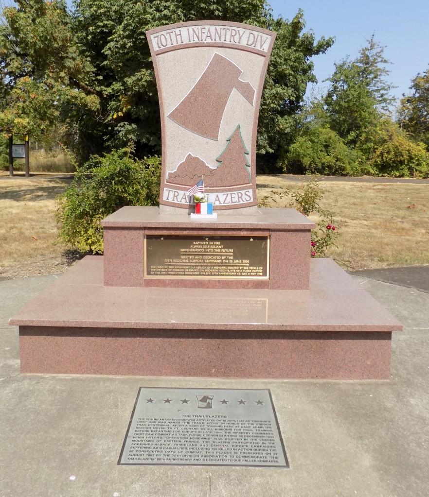
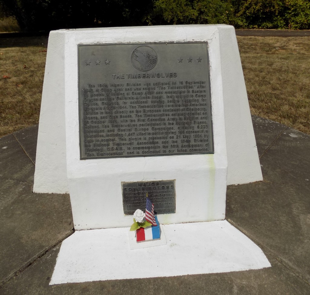

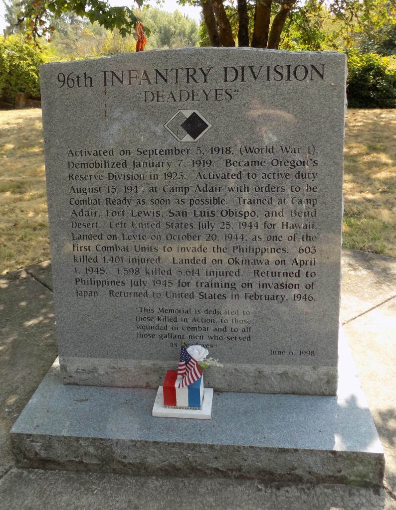
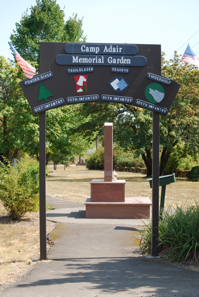
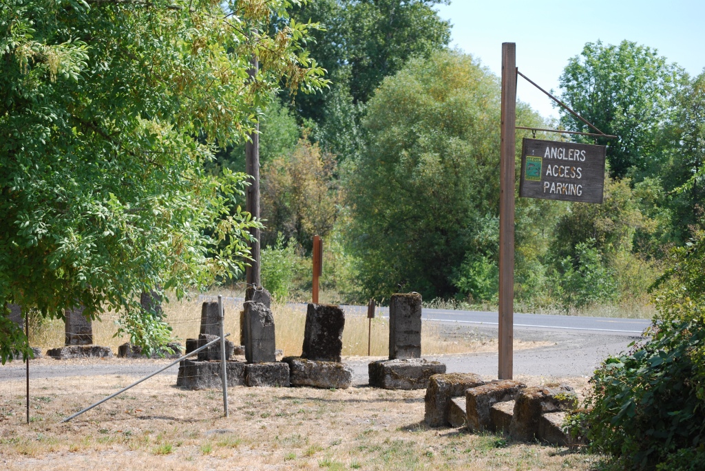


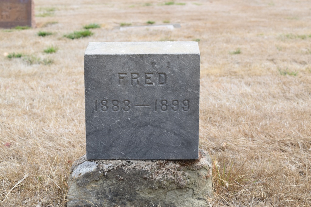

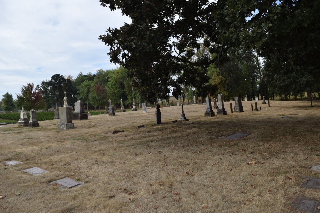
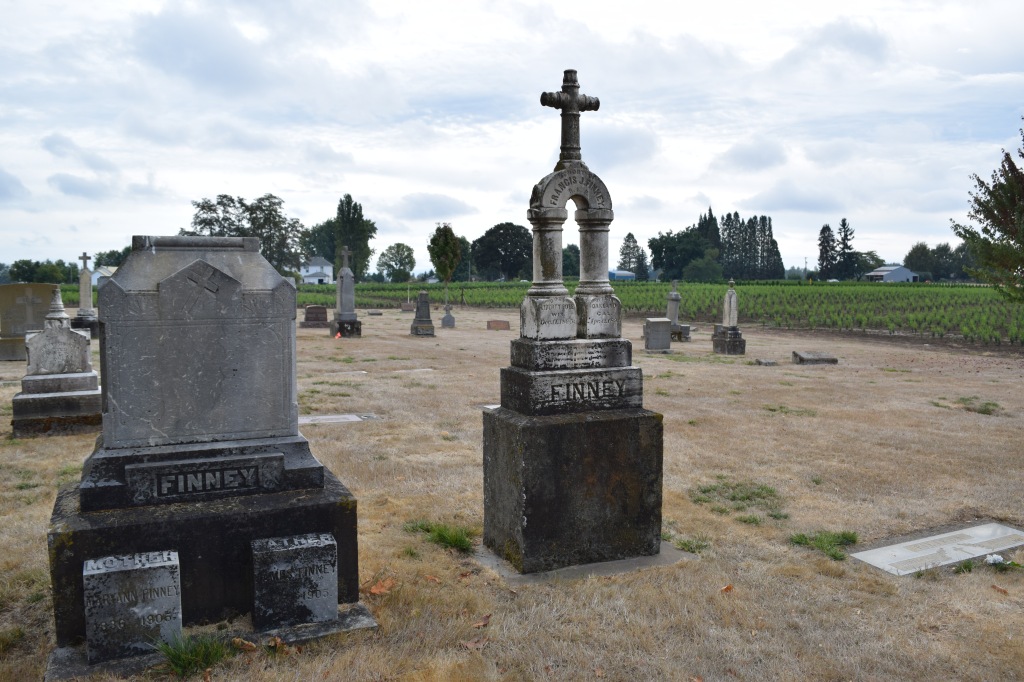
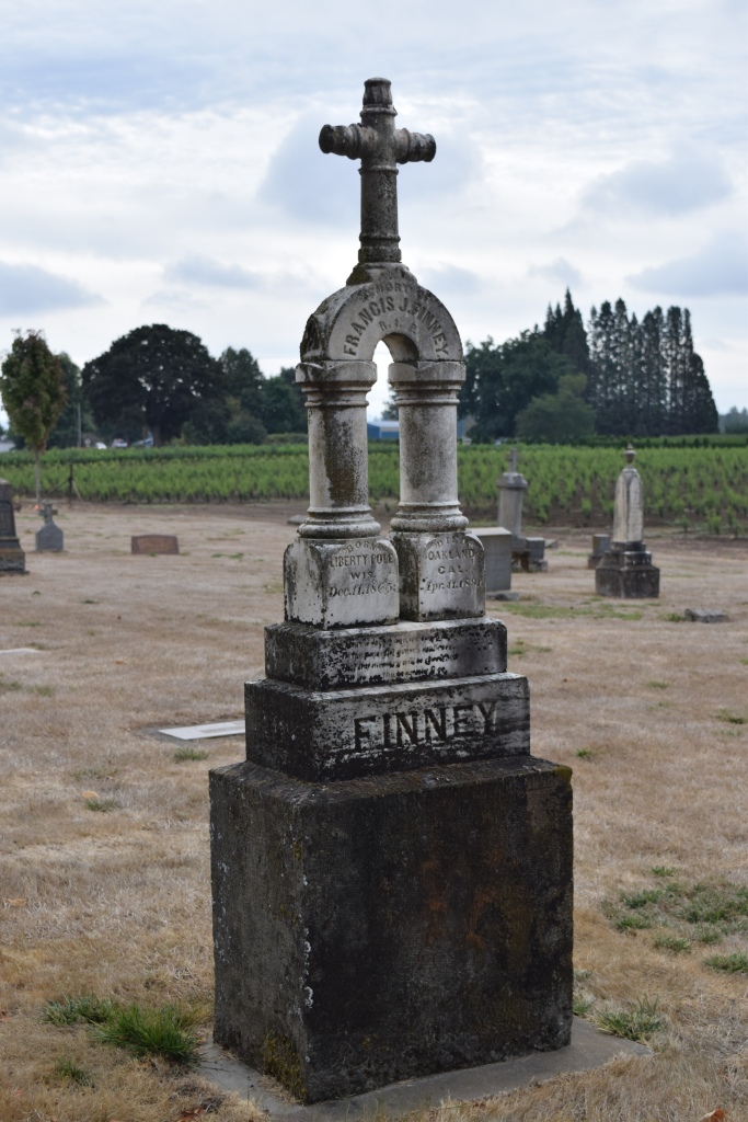


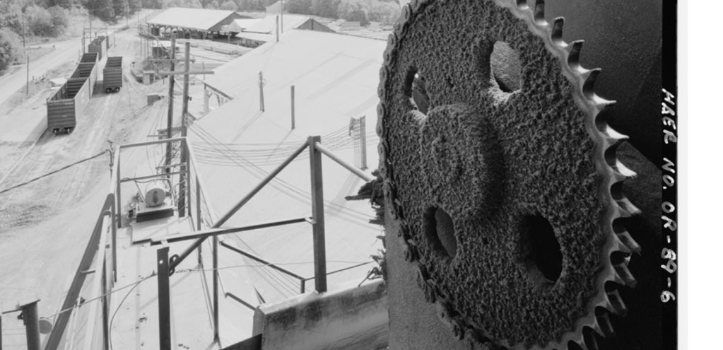
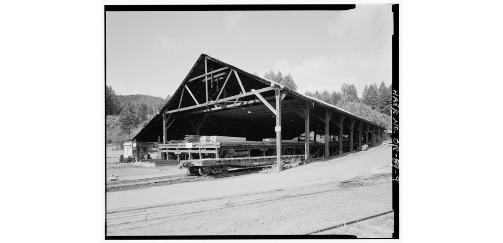


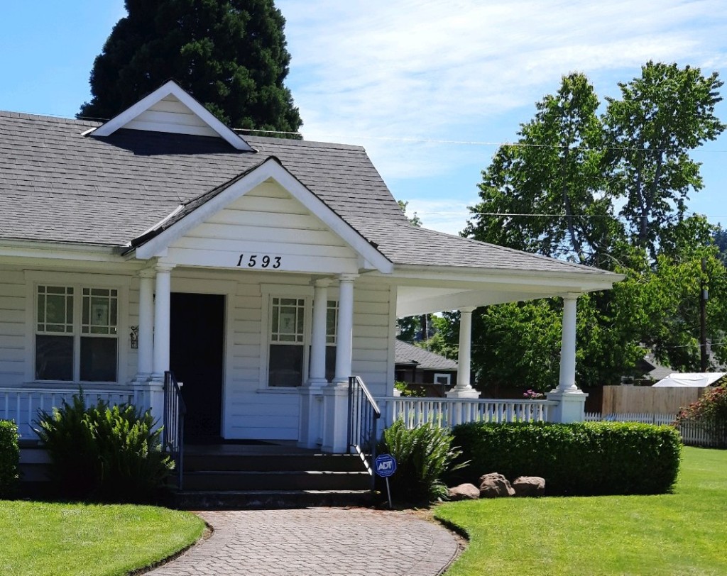

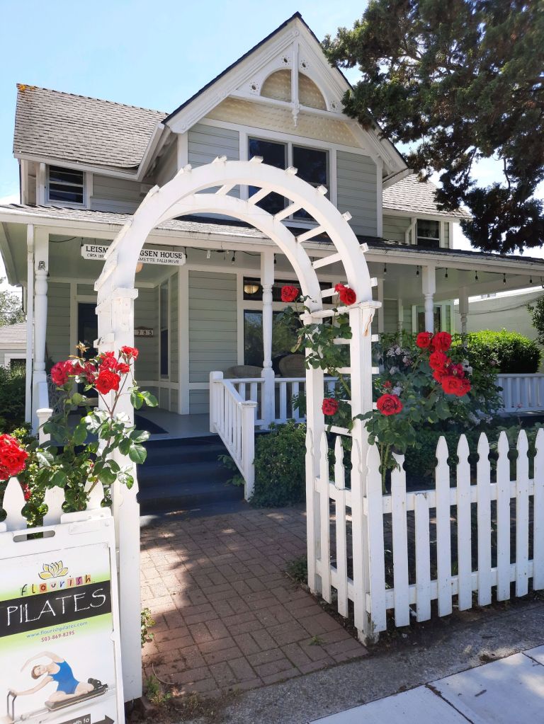


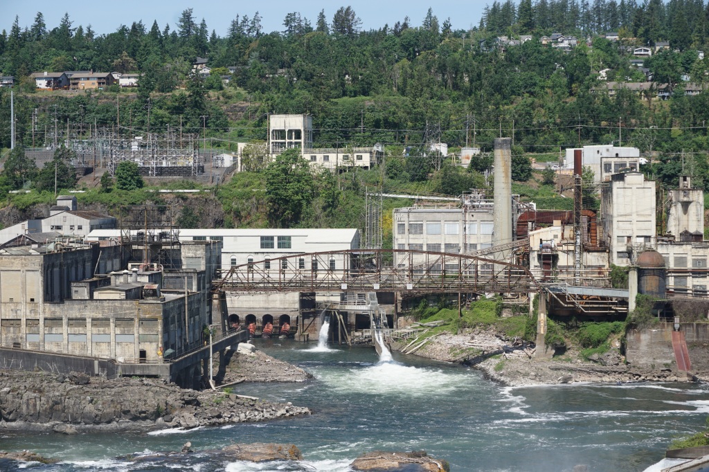
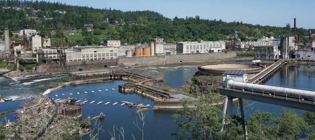
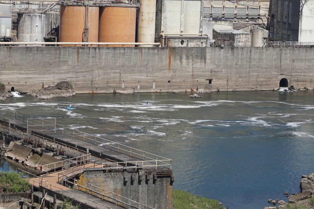
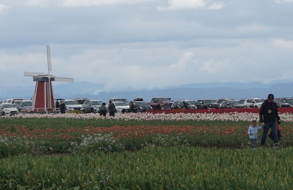
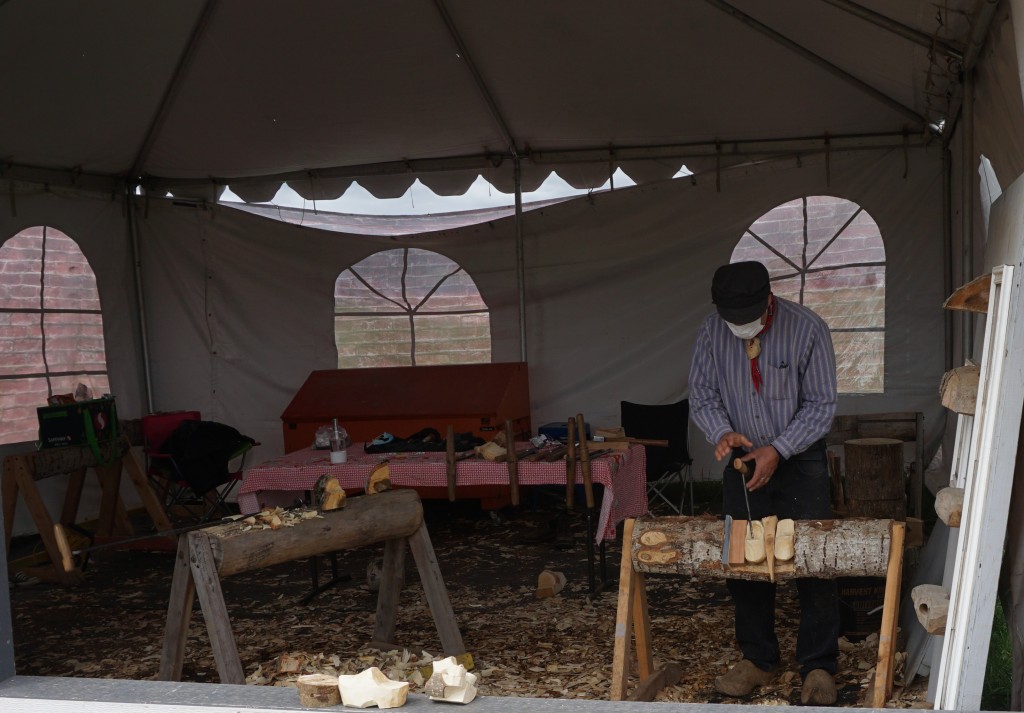


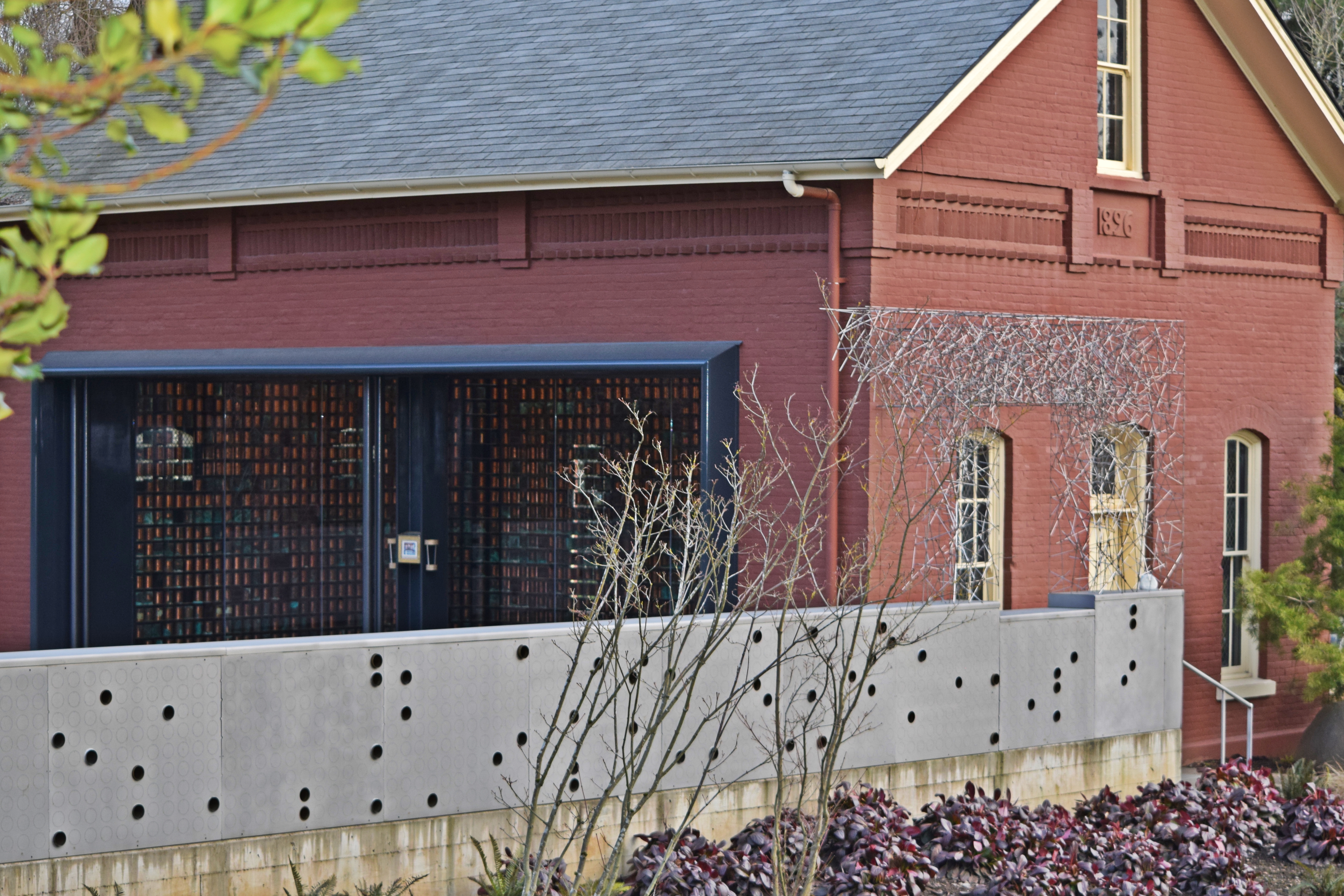


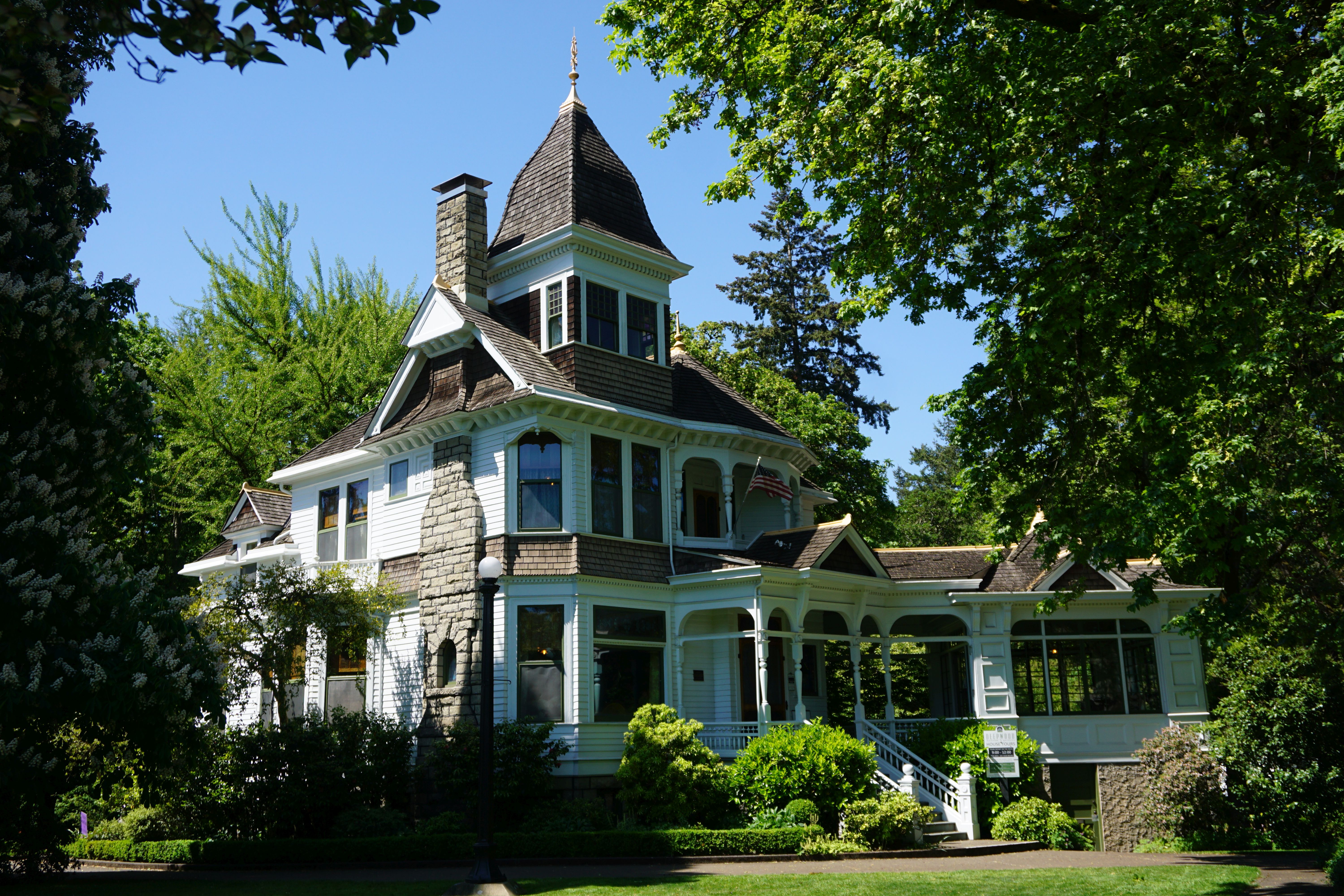
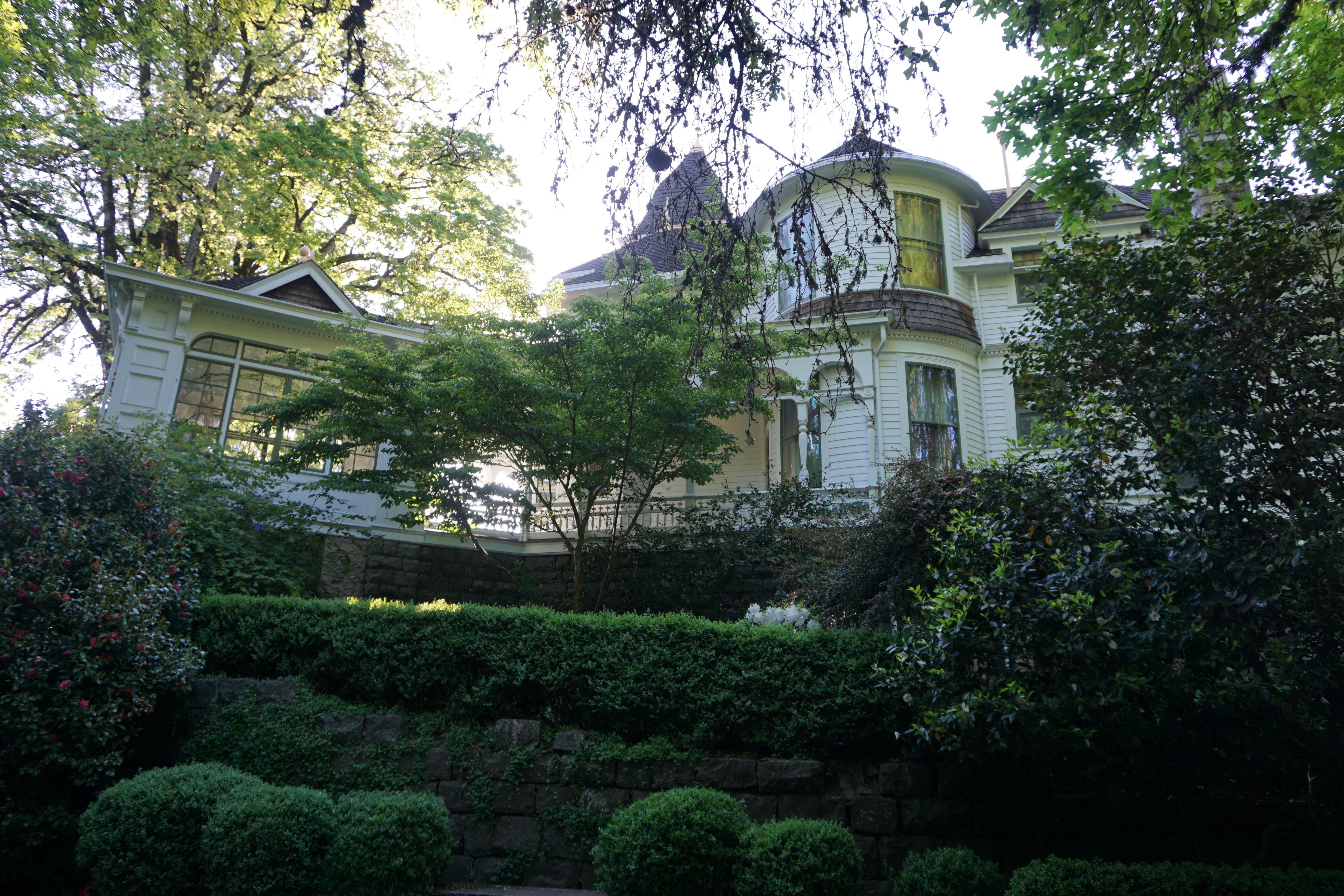
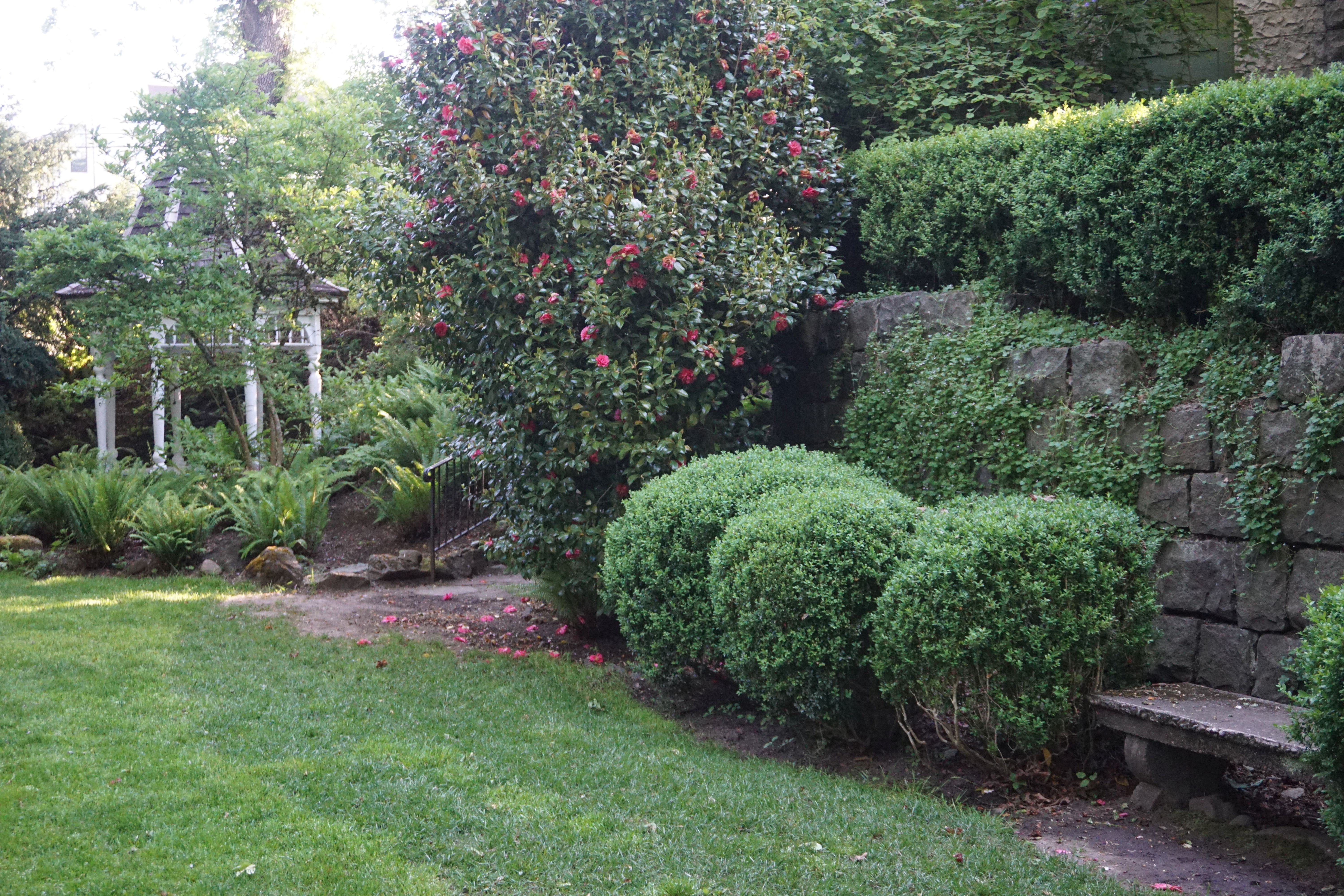
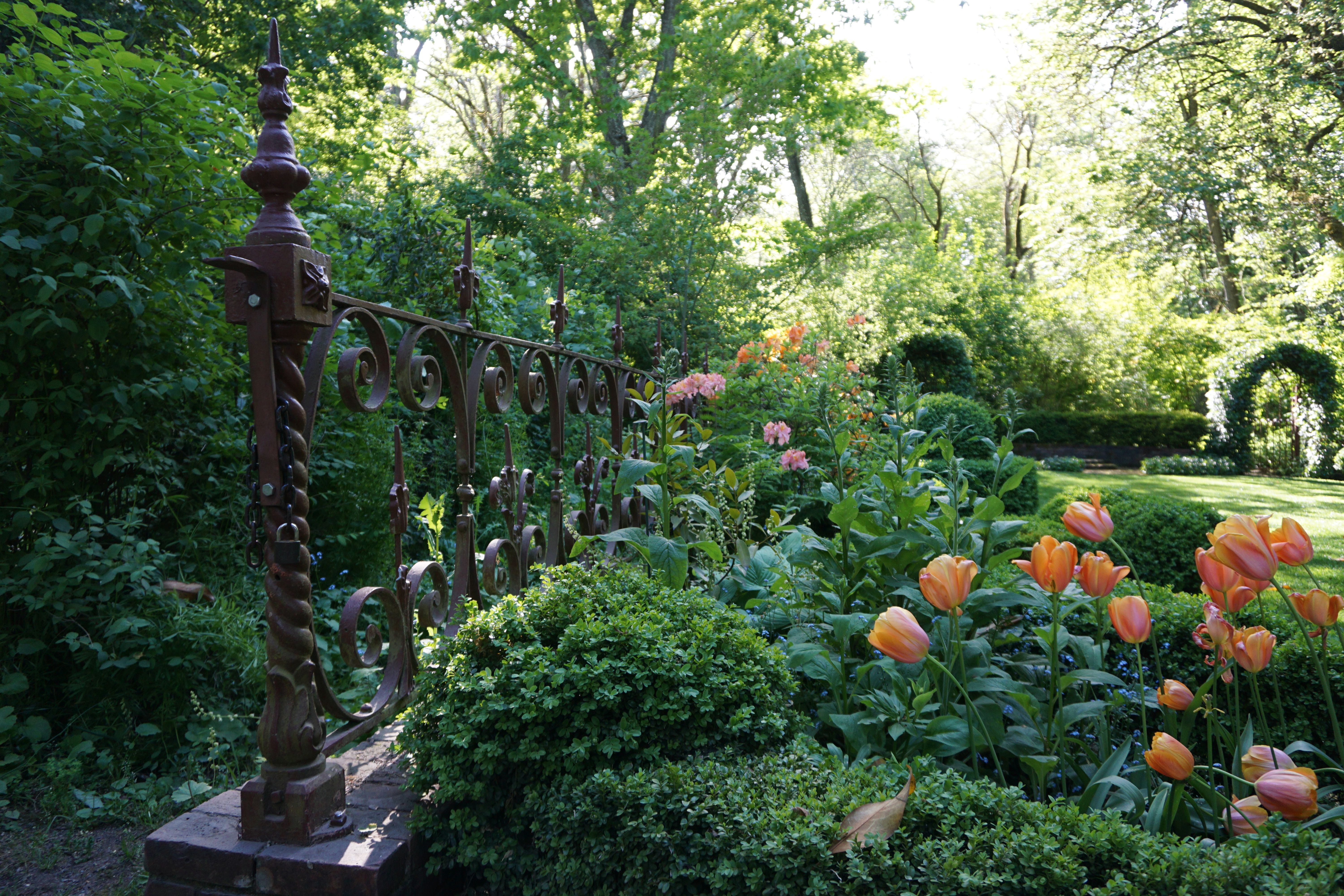

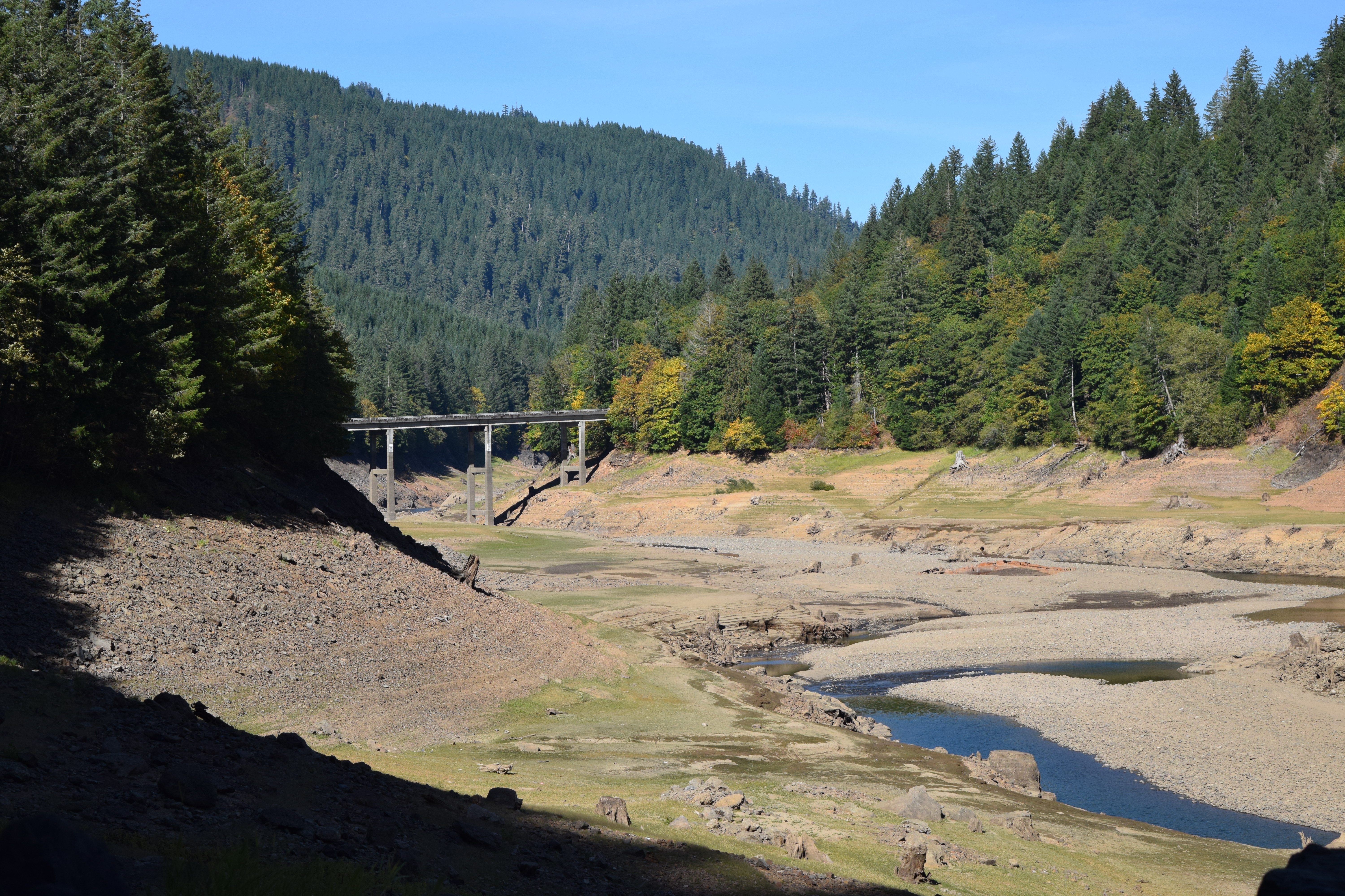

 in 1989 due in part to the Oregon Covered Bridge Program.
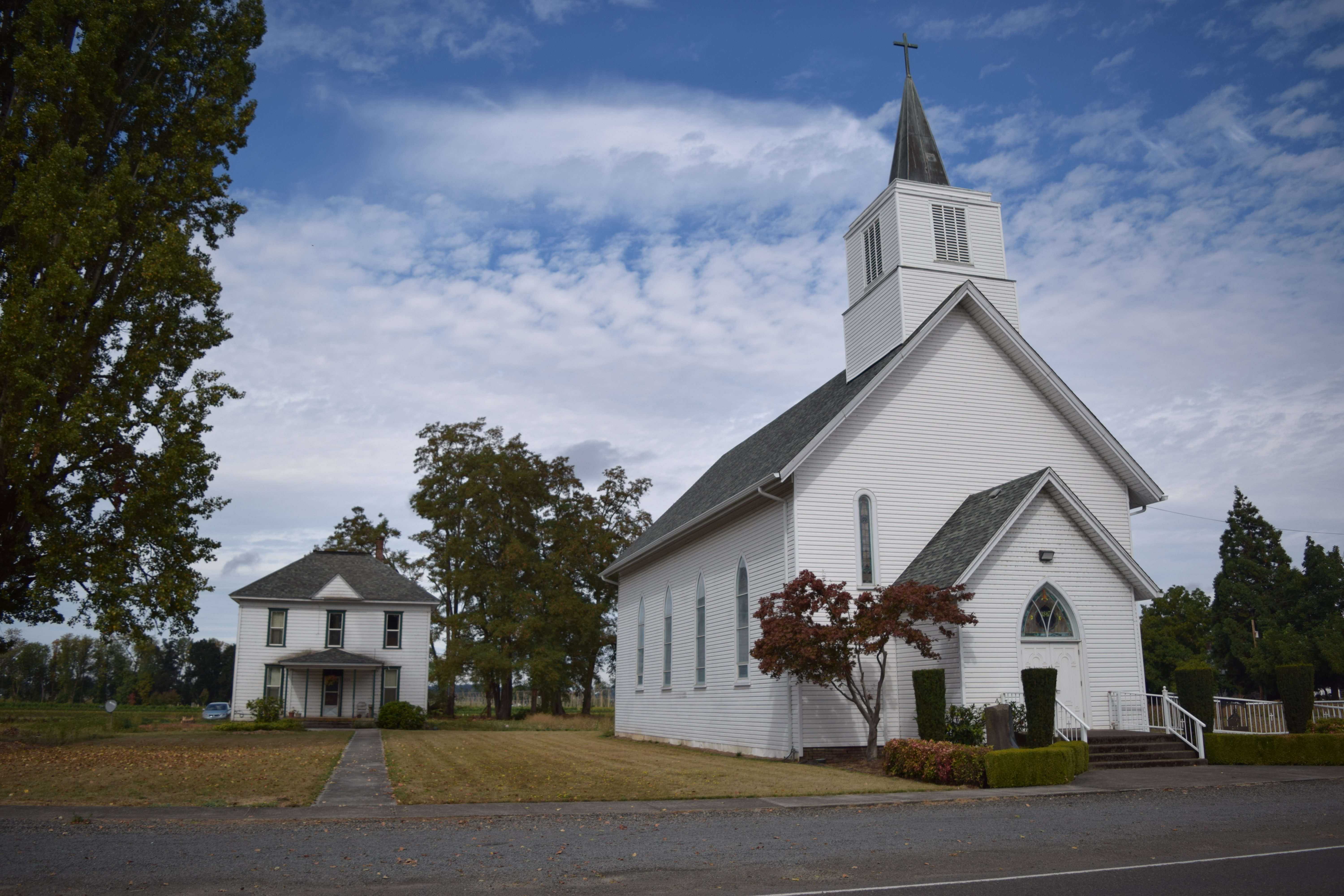
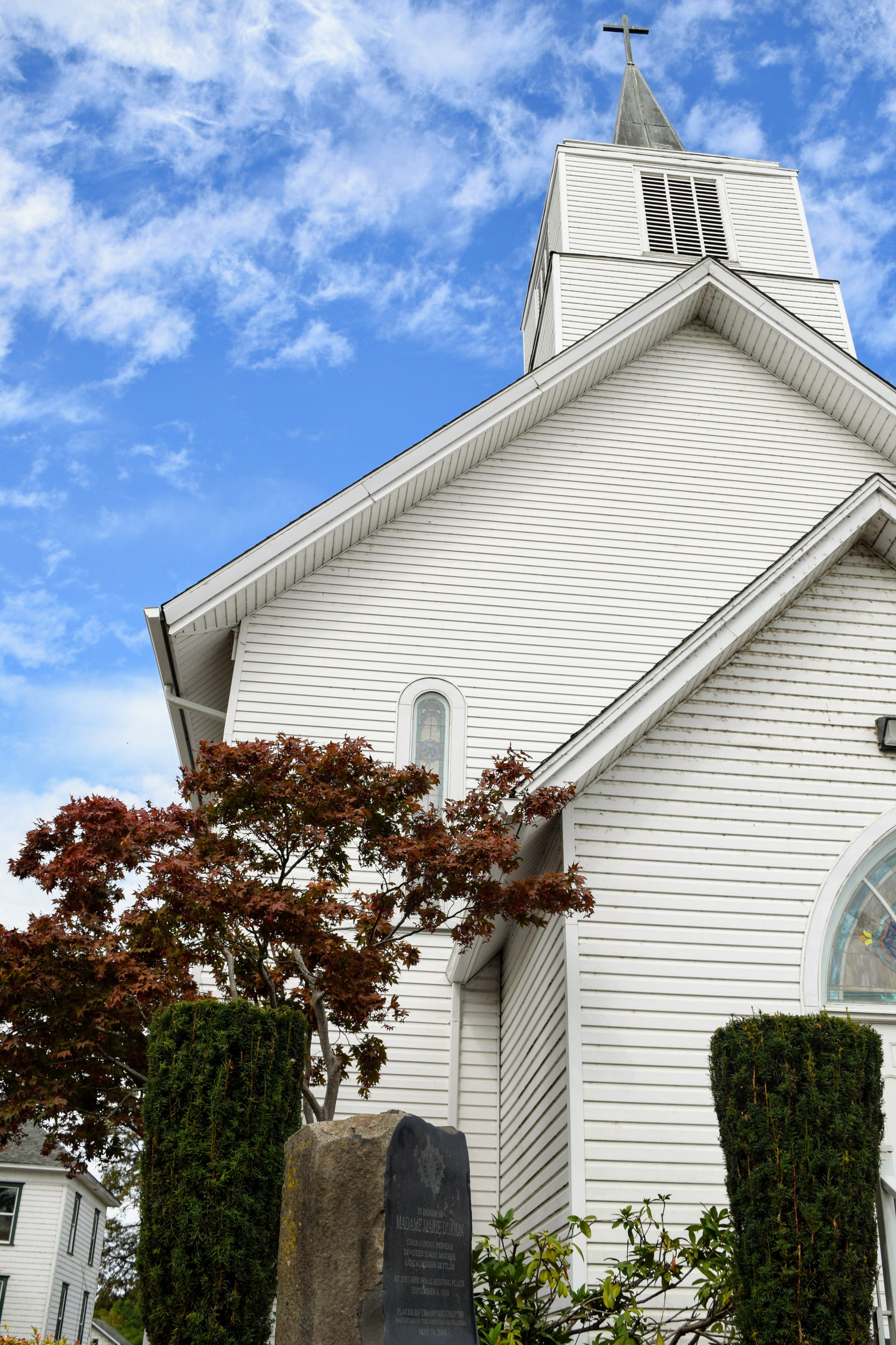
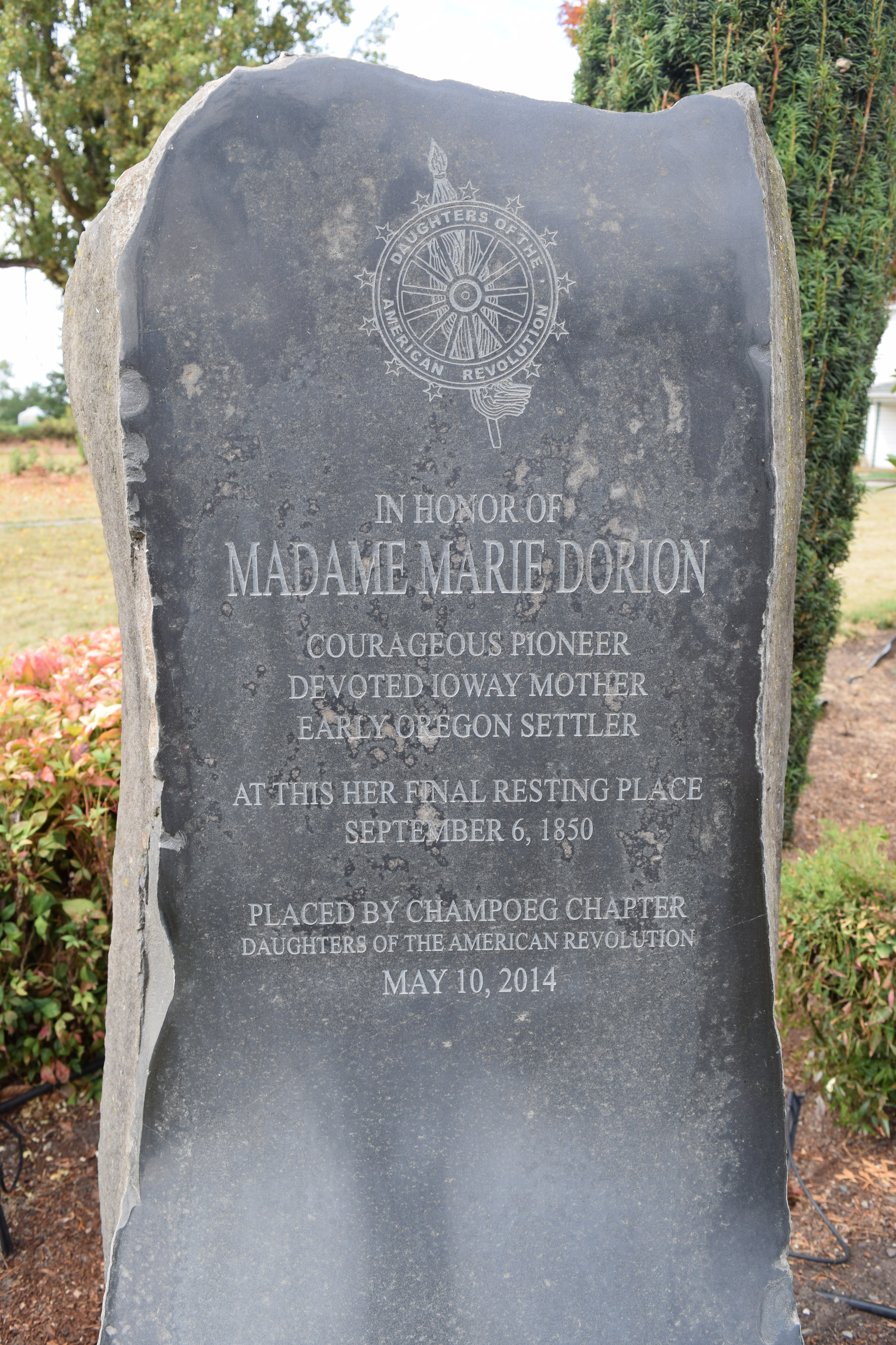

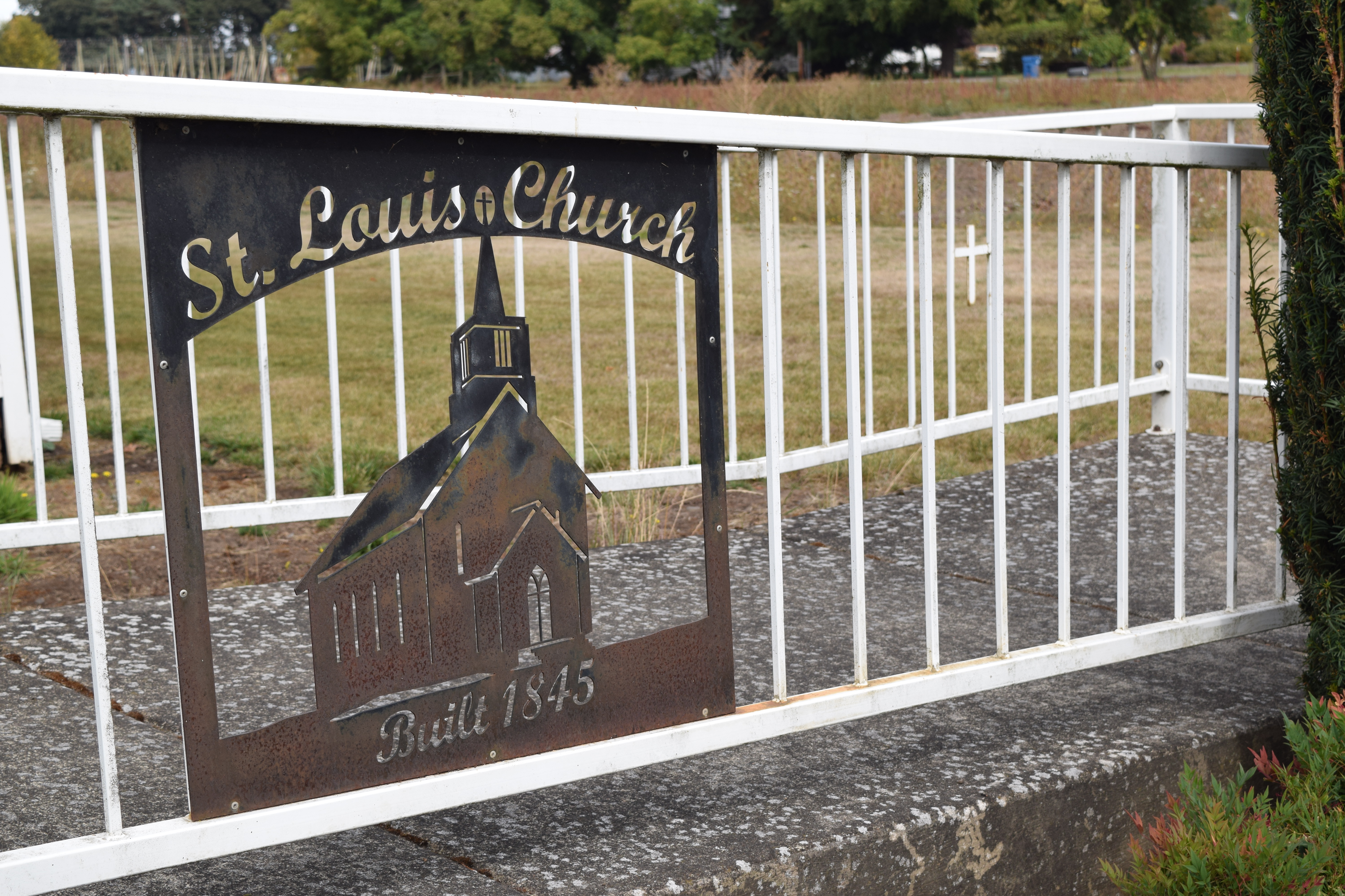


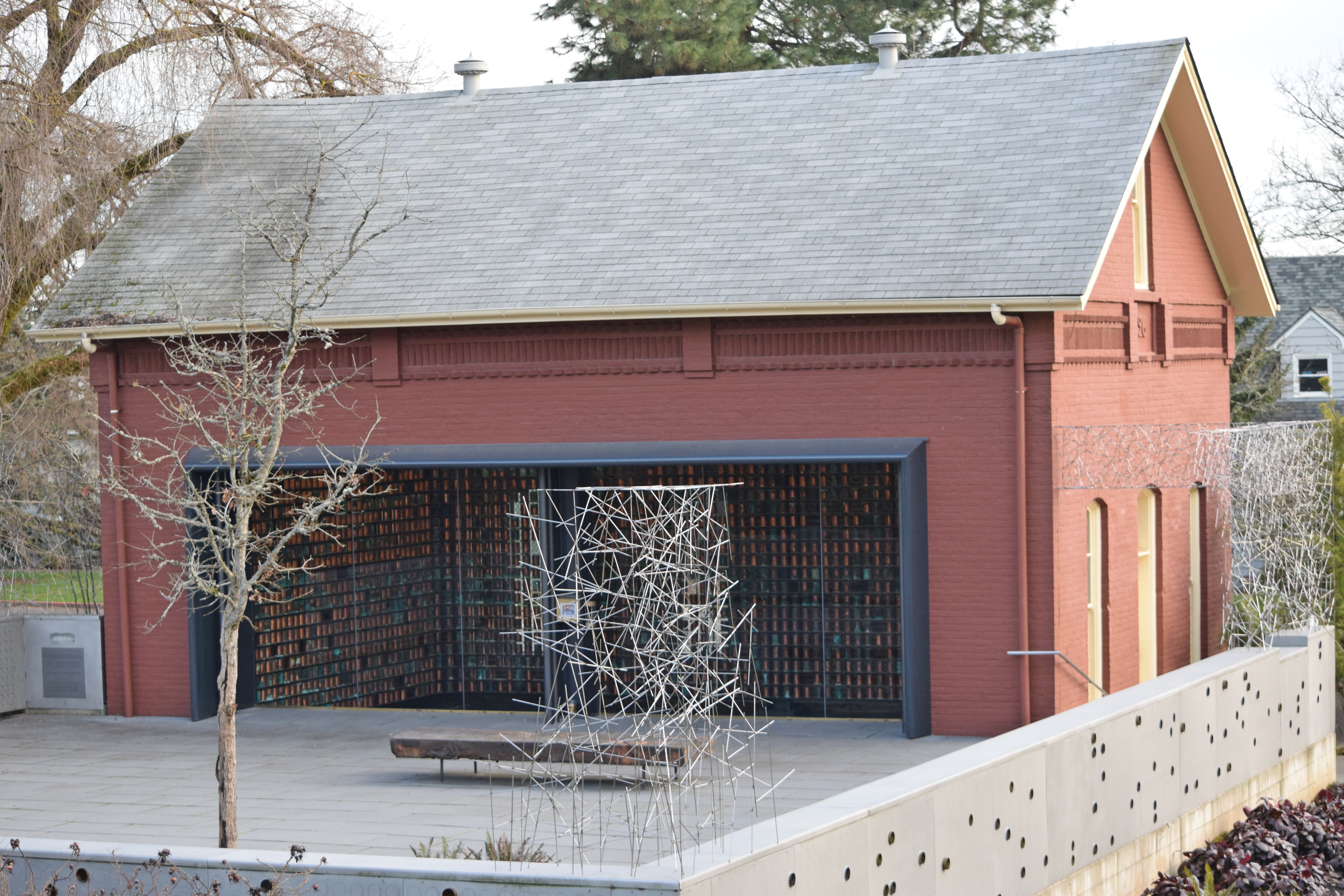

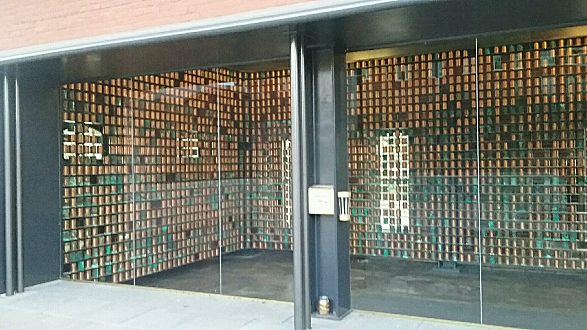


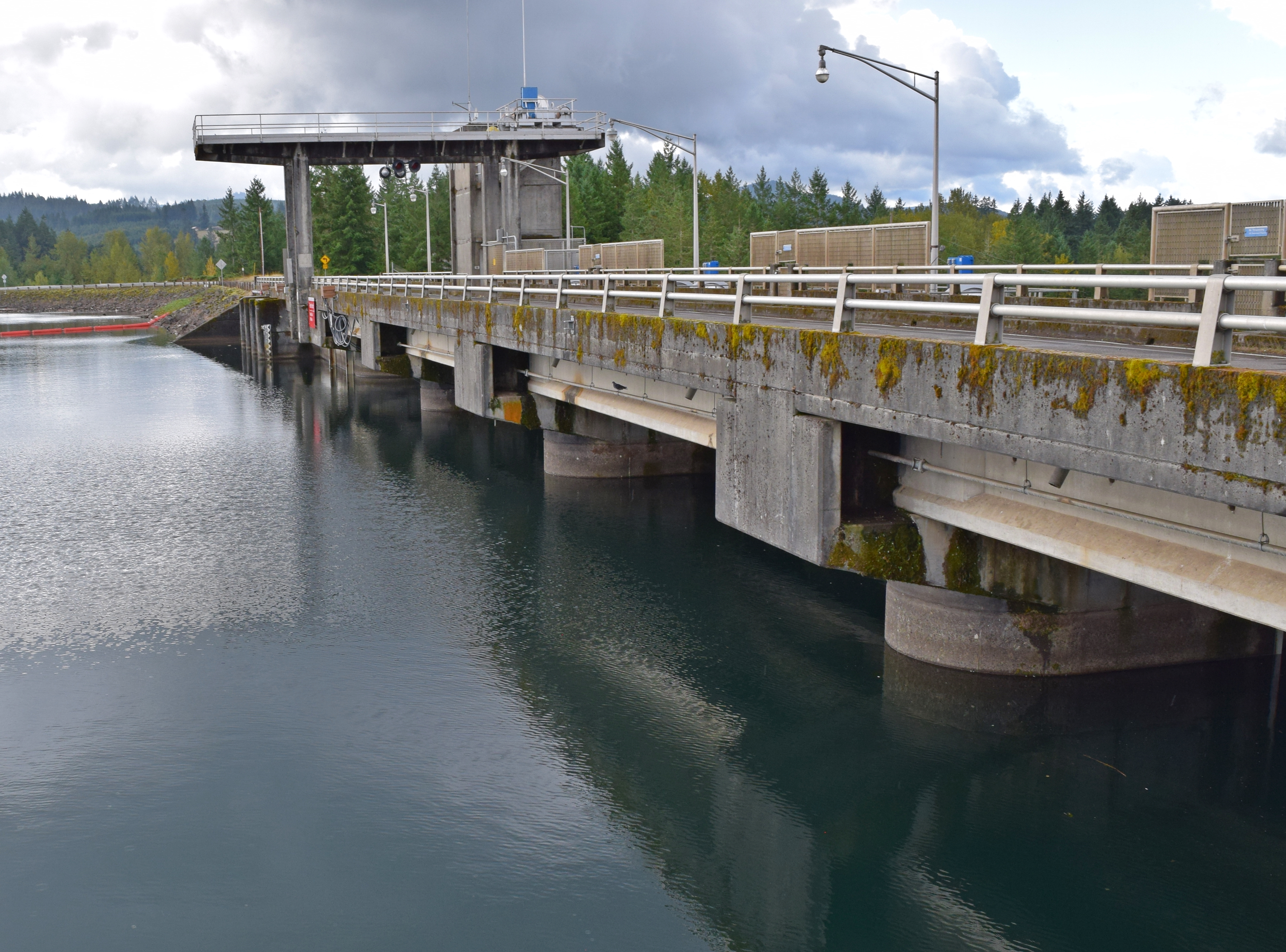


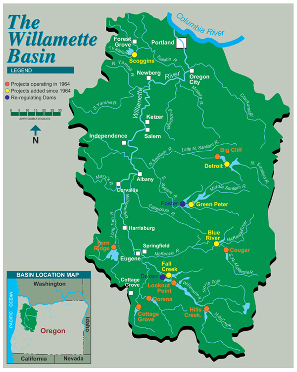


 salemhistory.net
 salemhistory.net
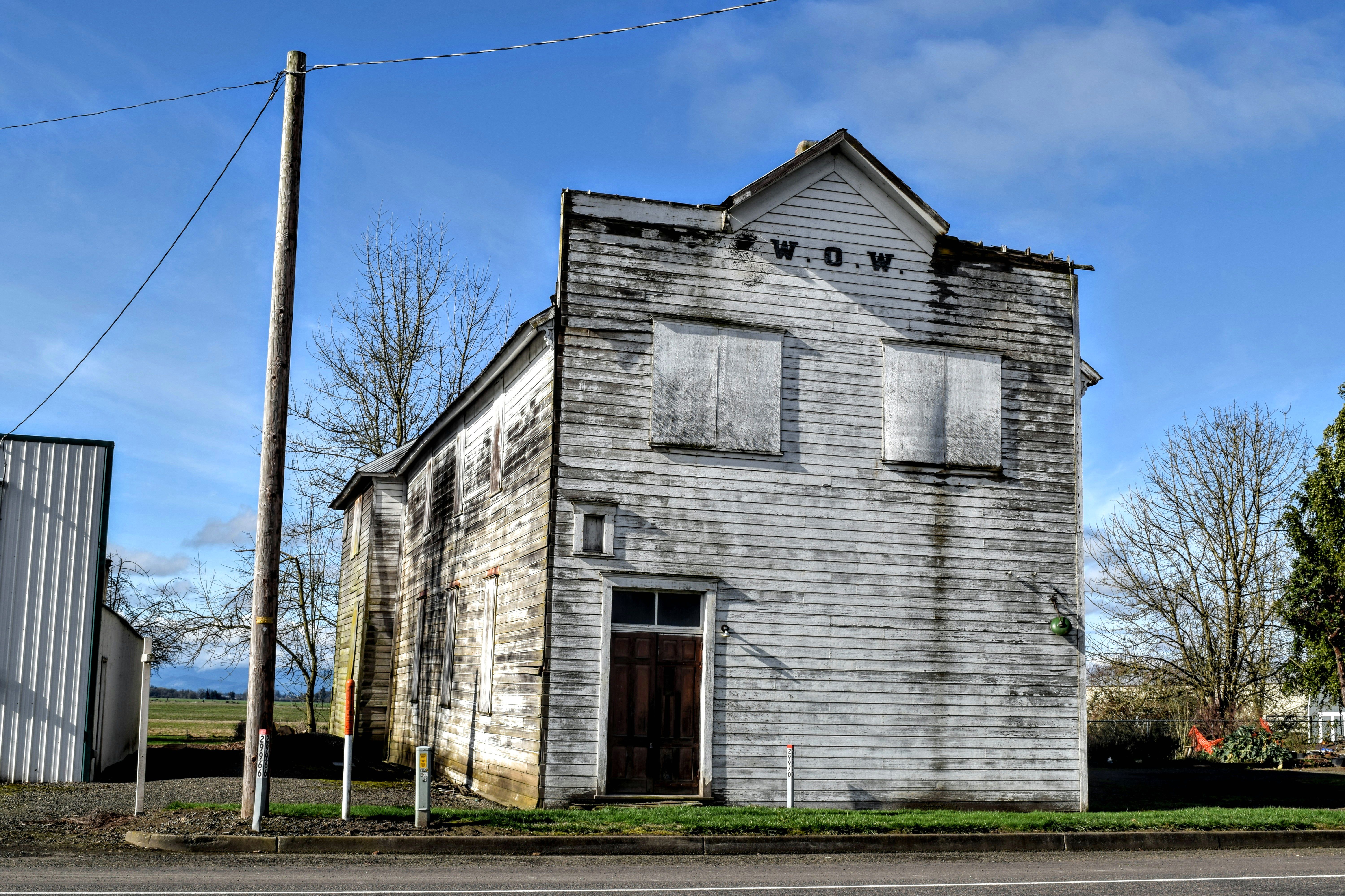
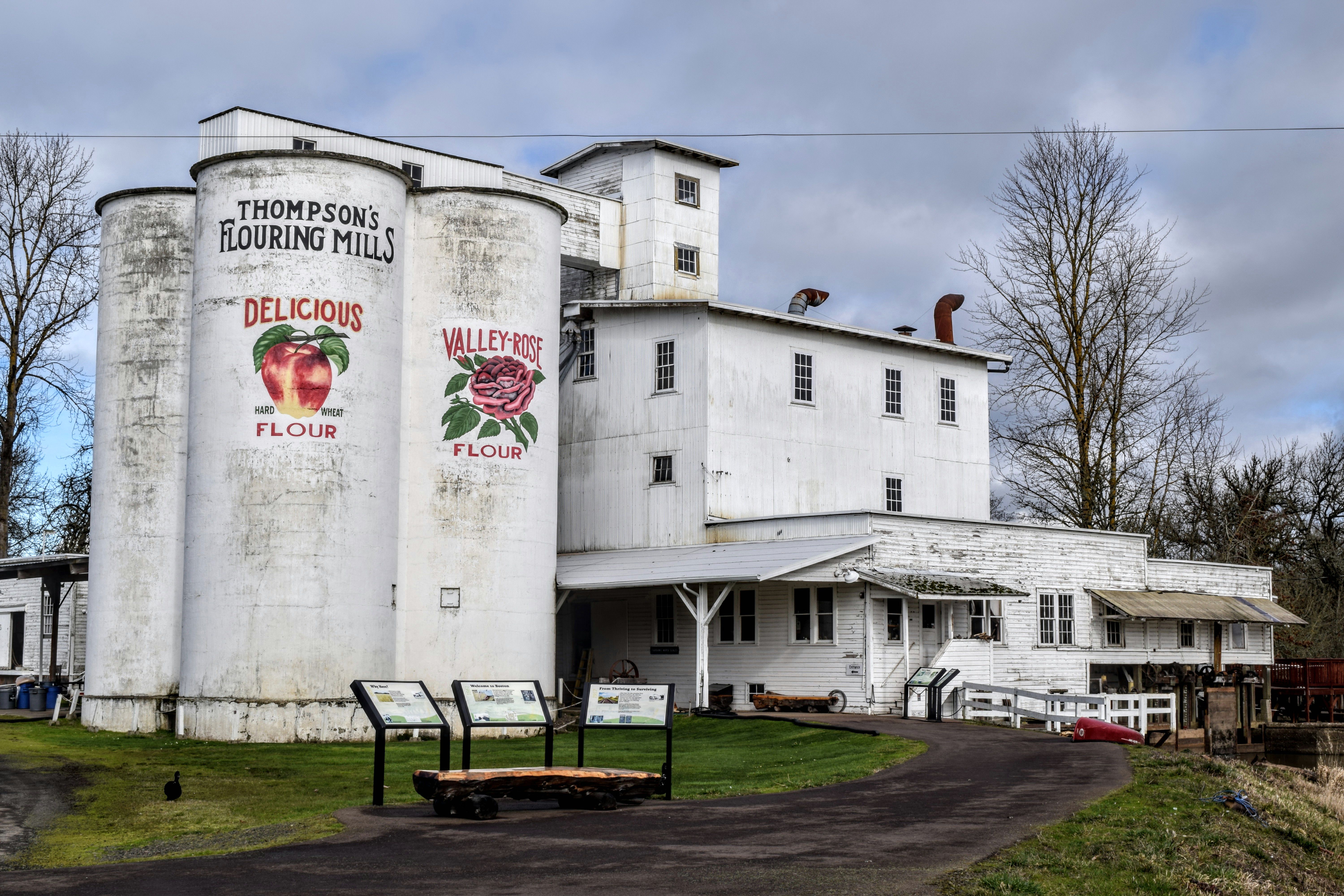


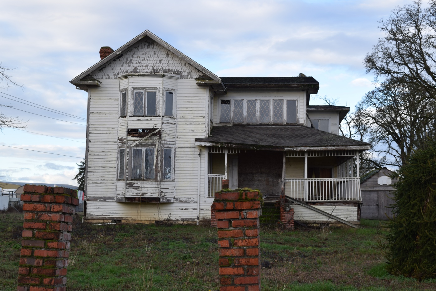


